Mount St Helens Aerial Photography
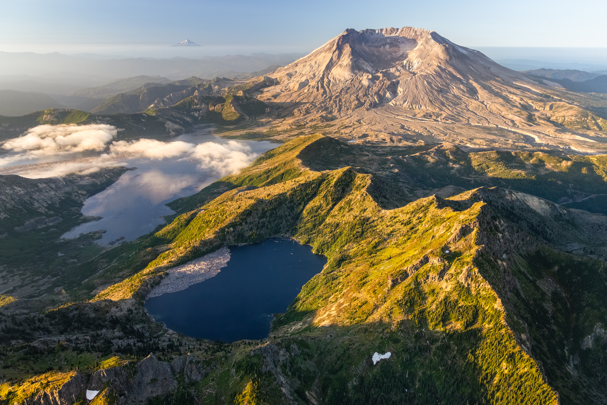
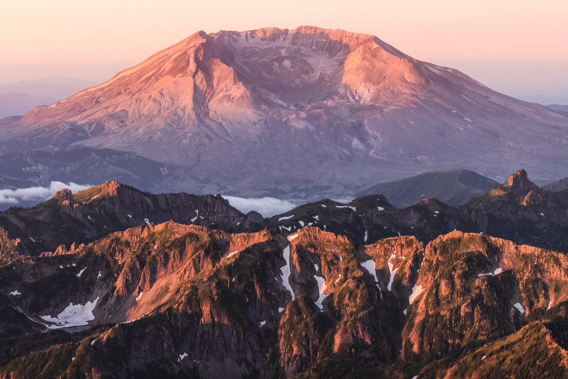
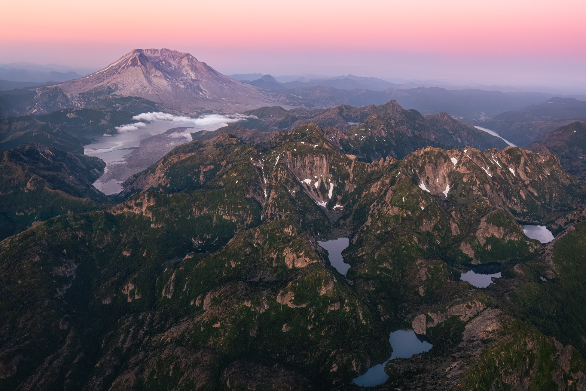
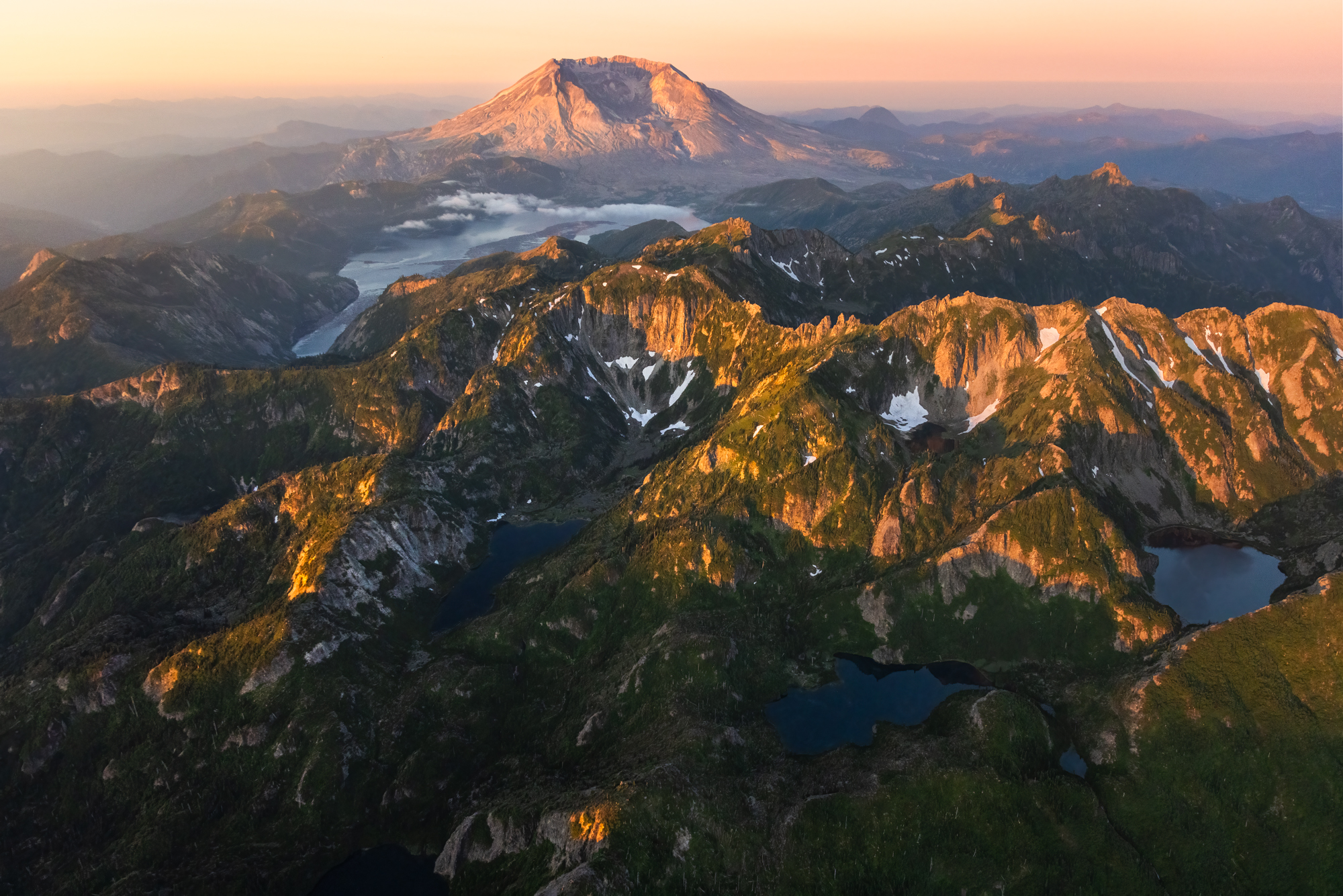
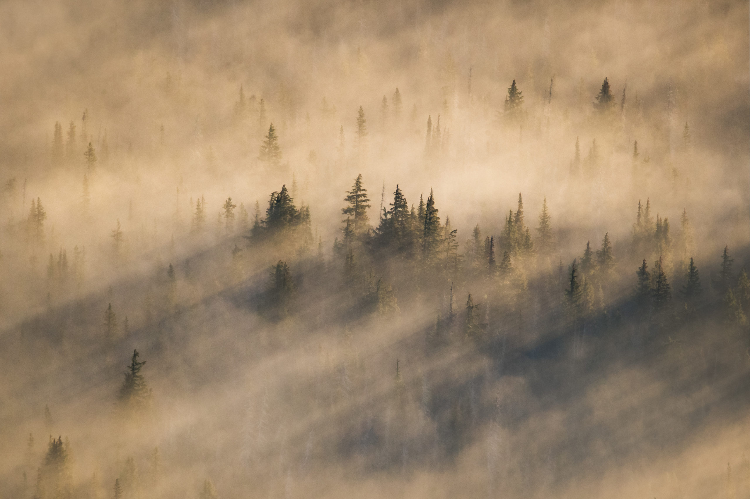
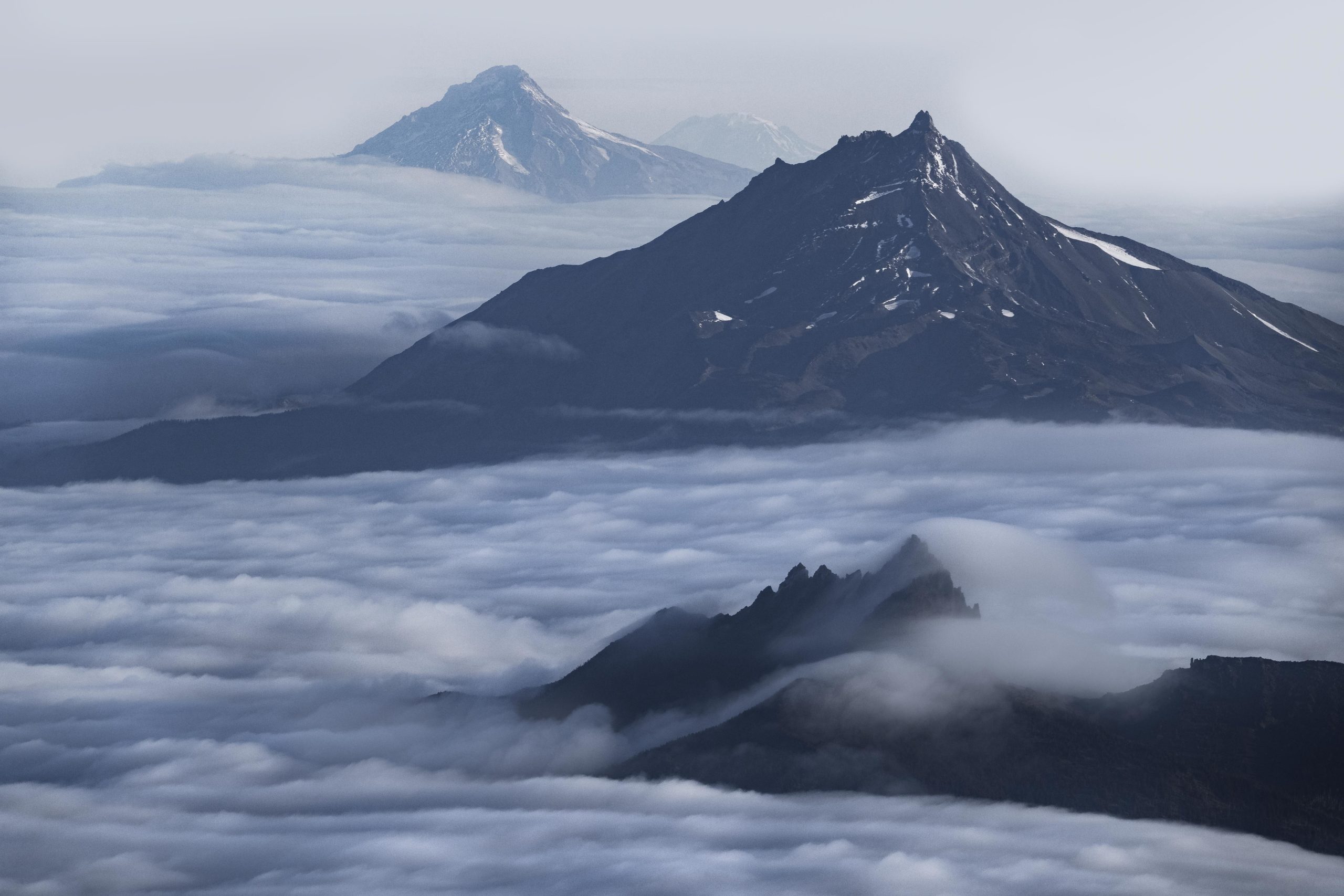
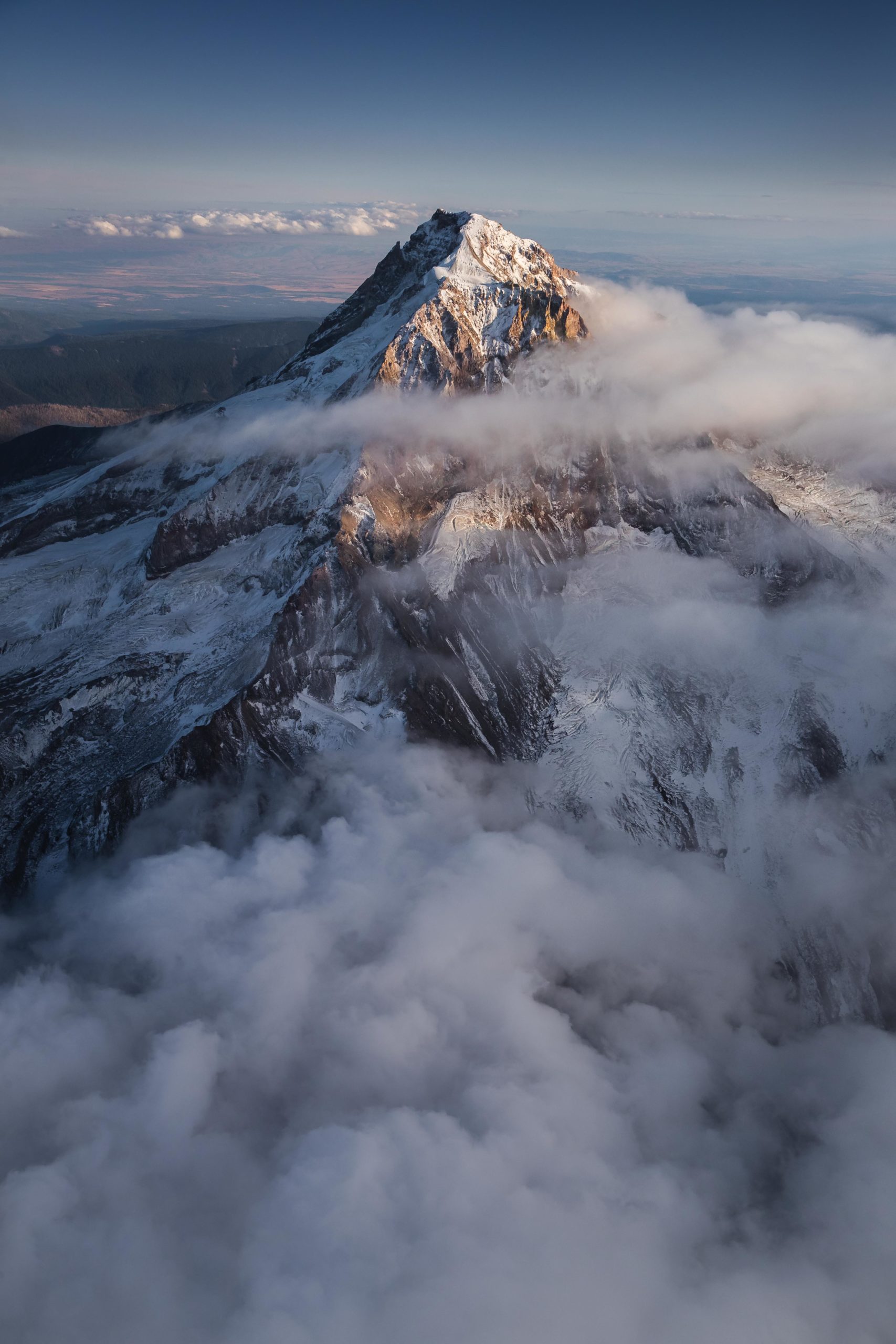
We began the flight just before sunrise as the pre-dawn glow softly illuminated Mount St Helens and the surrounding ridge-lines and alpine lakes.
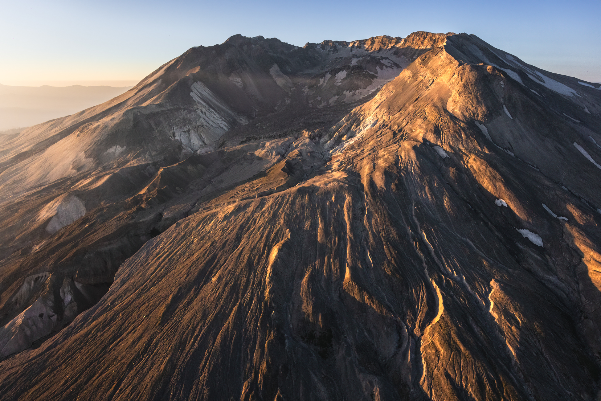
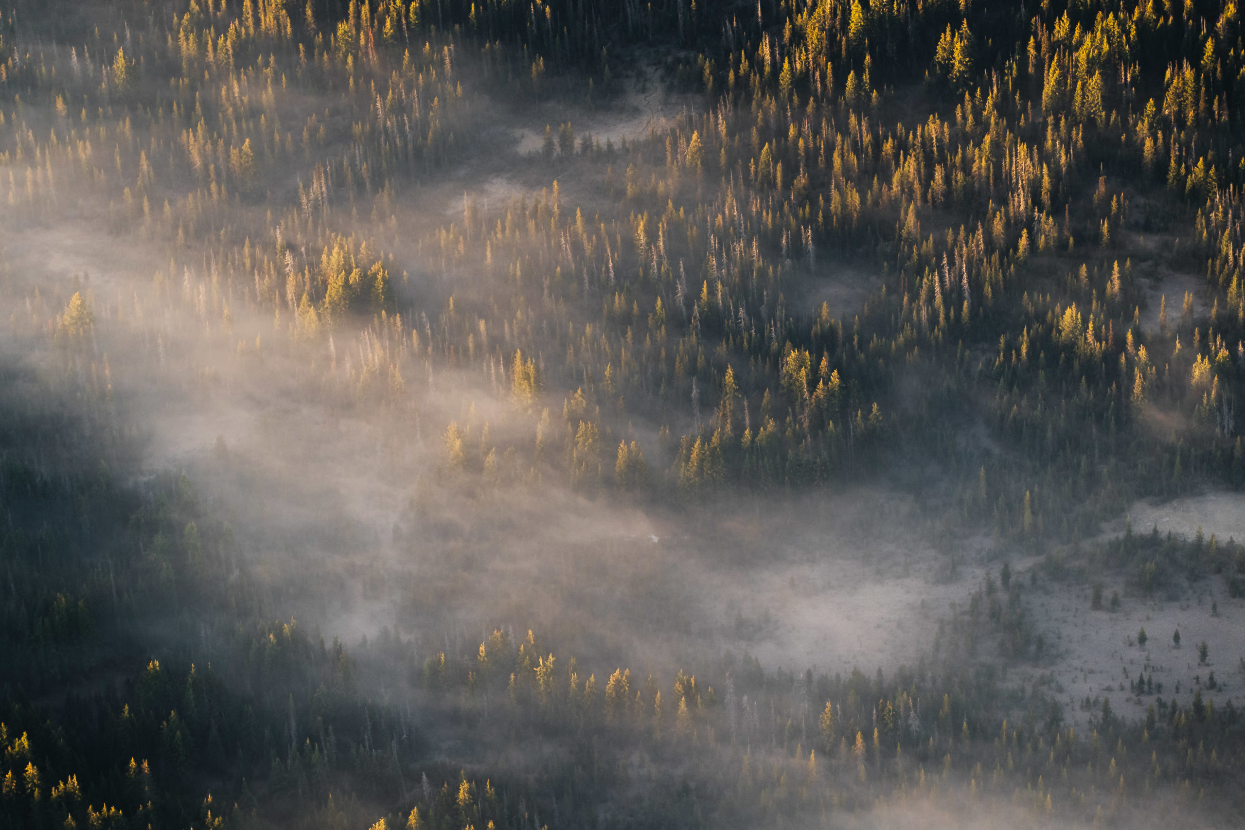
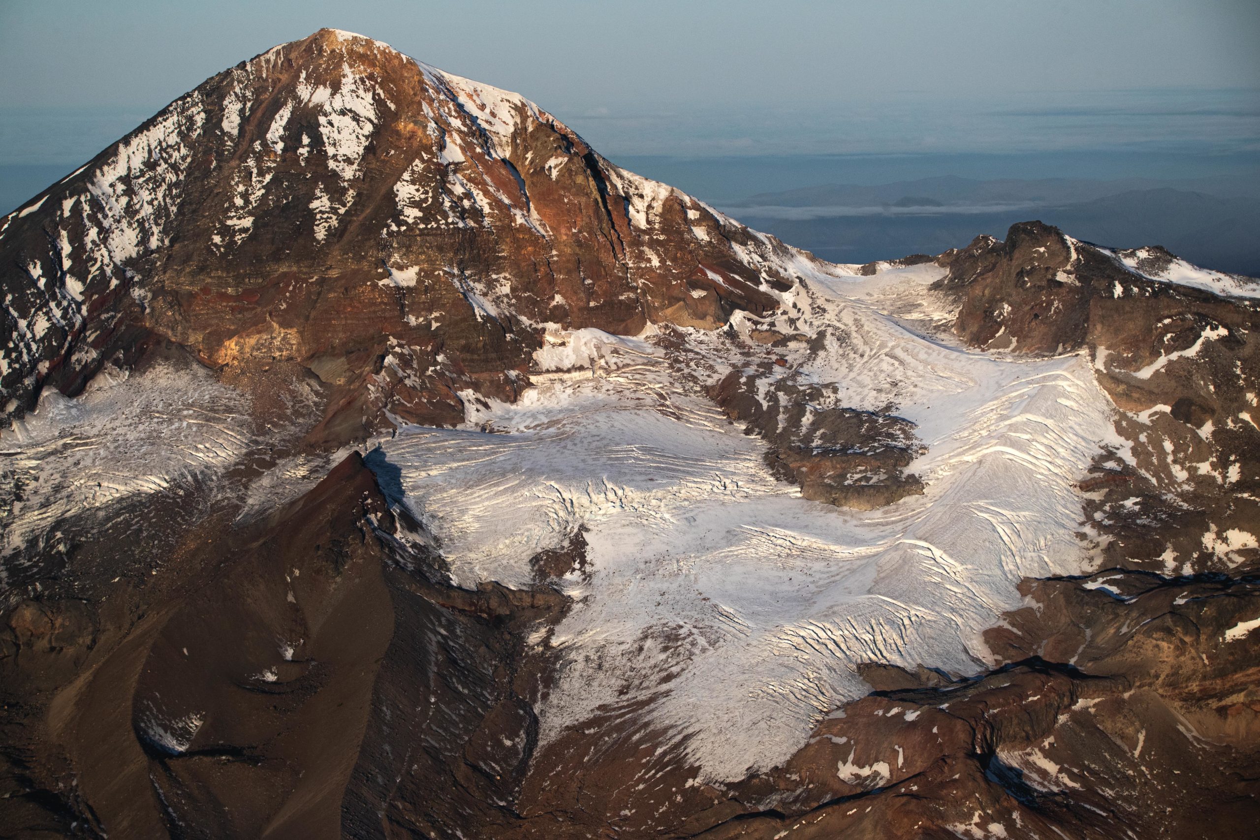
Just after sunrise, Mount St Helens quickly became illuminated by the rising sun. The lack of snow cover from the hot and dry summer became much more apparent.
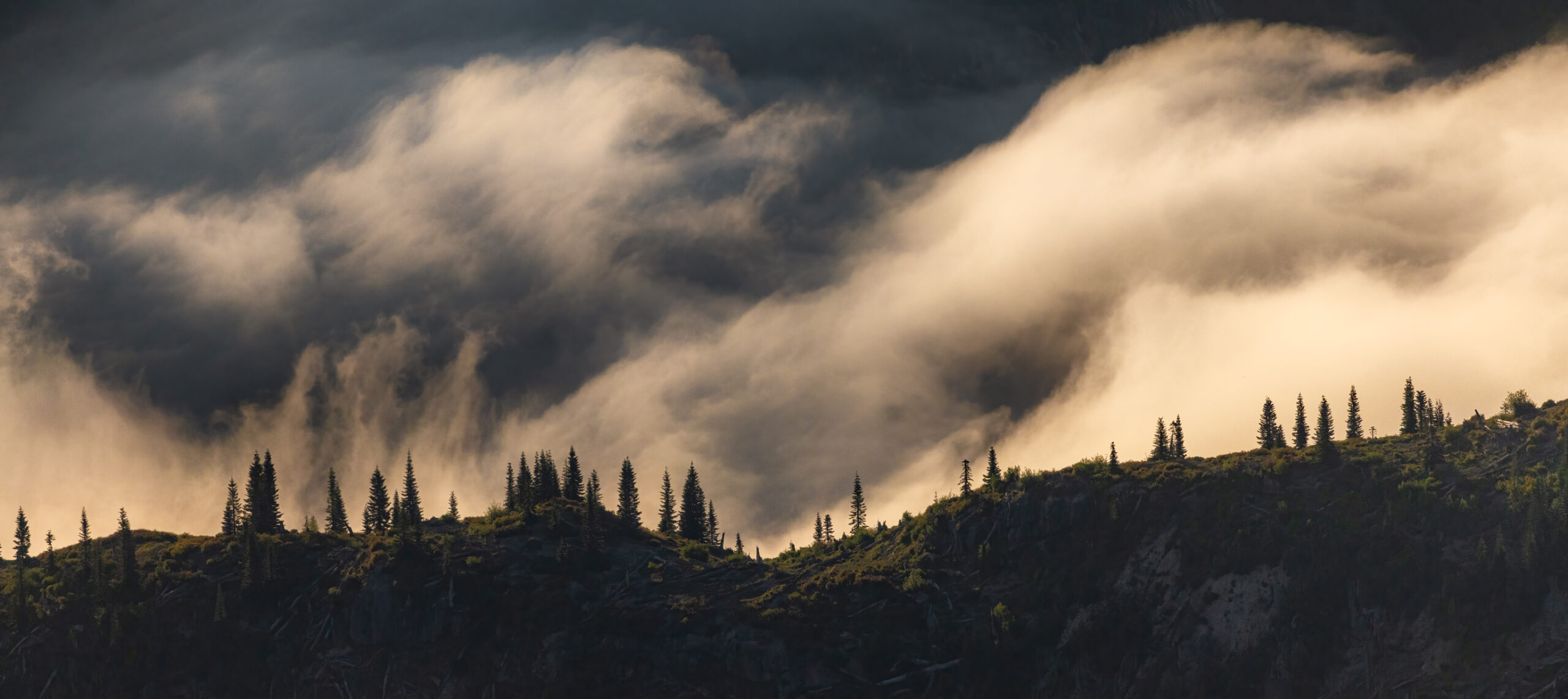
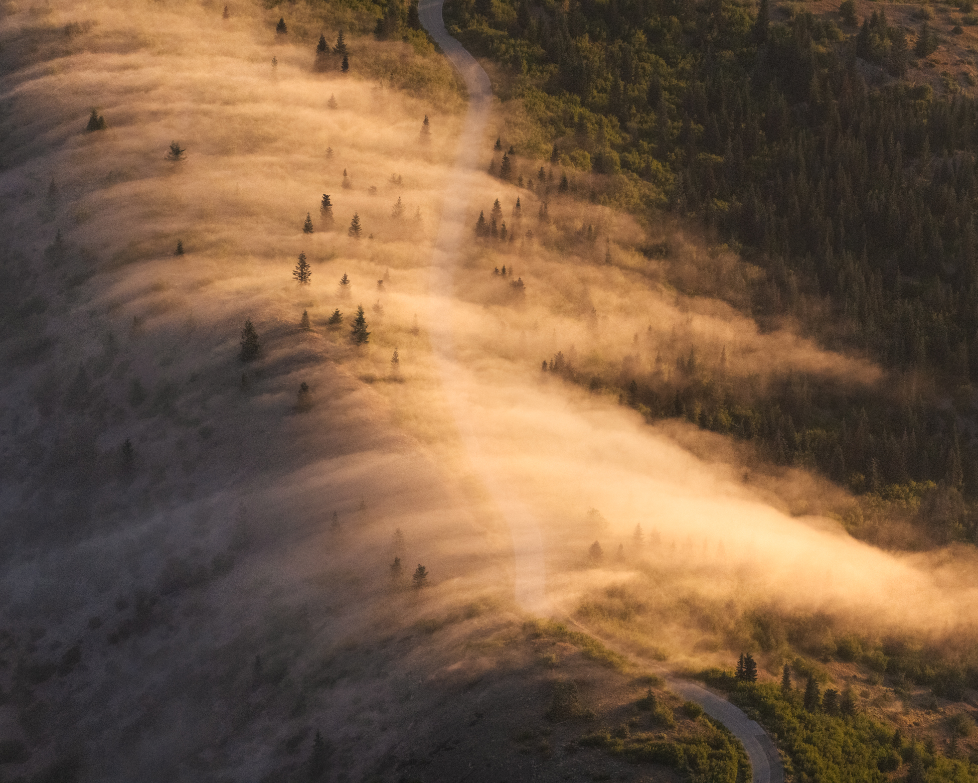
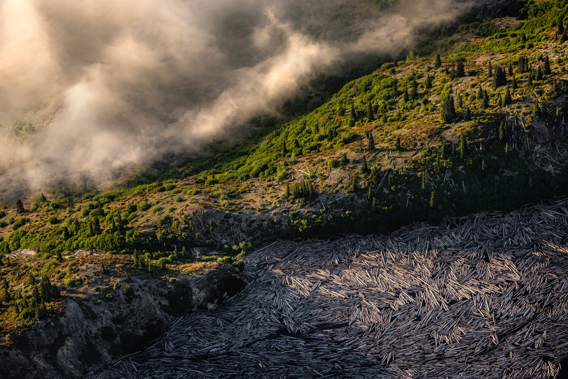
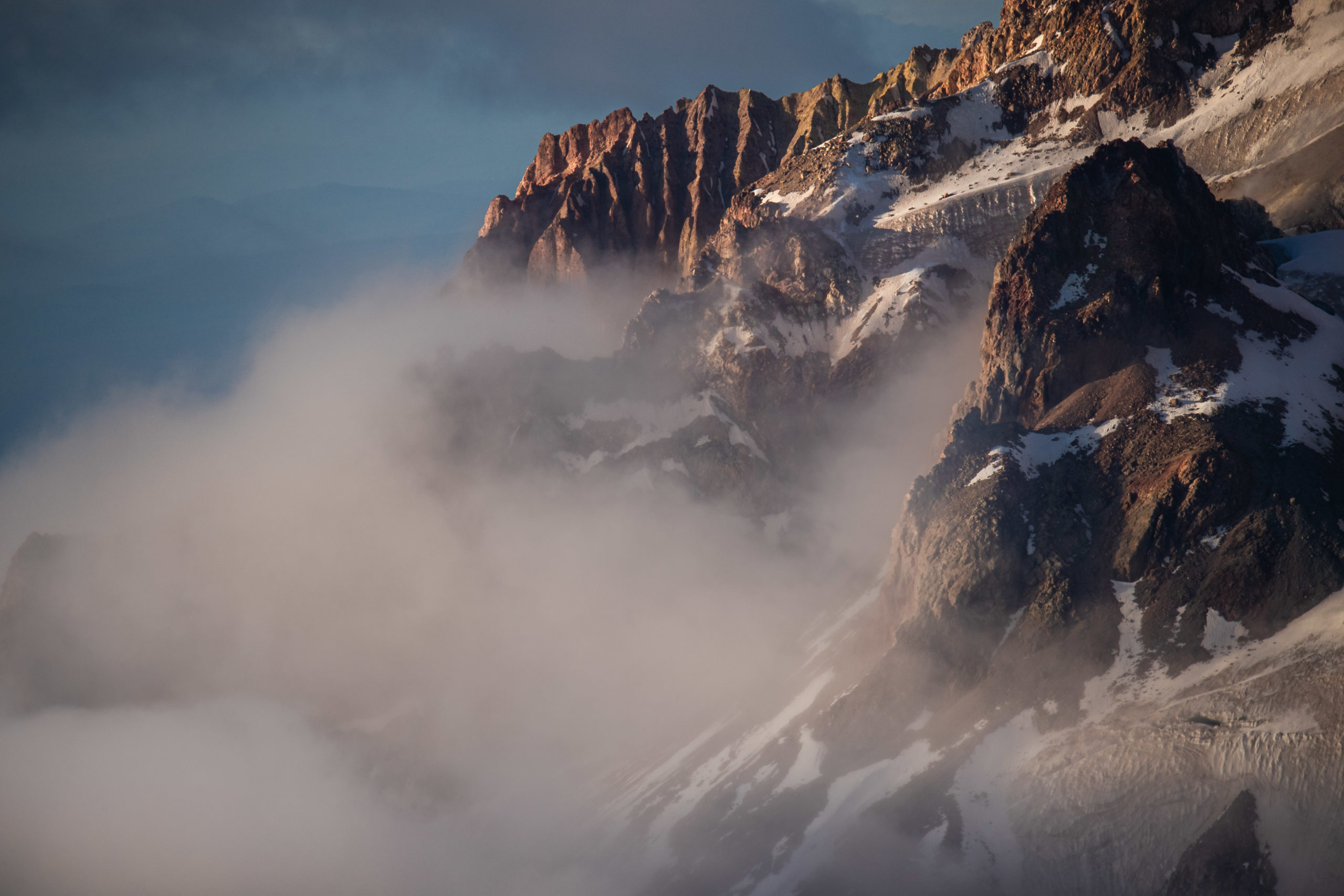
The early morning fog blanketing the landscape below was an added bonus. I loved the way the light illuminated the mist creating such a beautiful atmosphere.
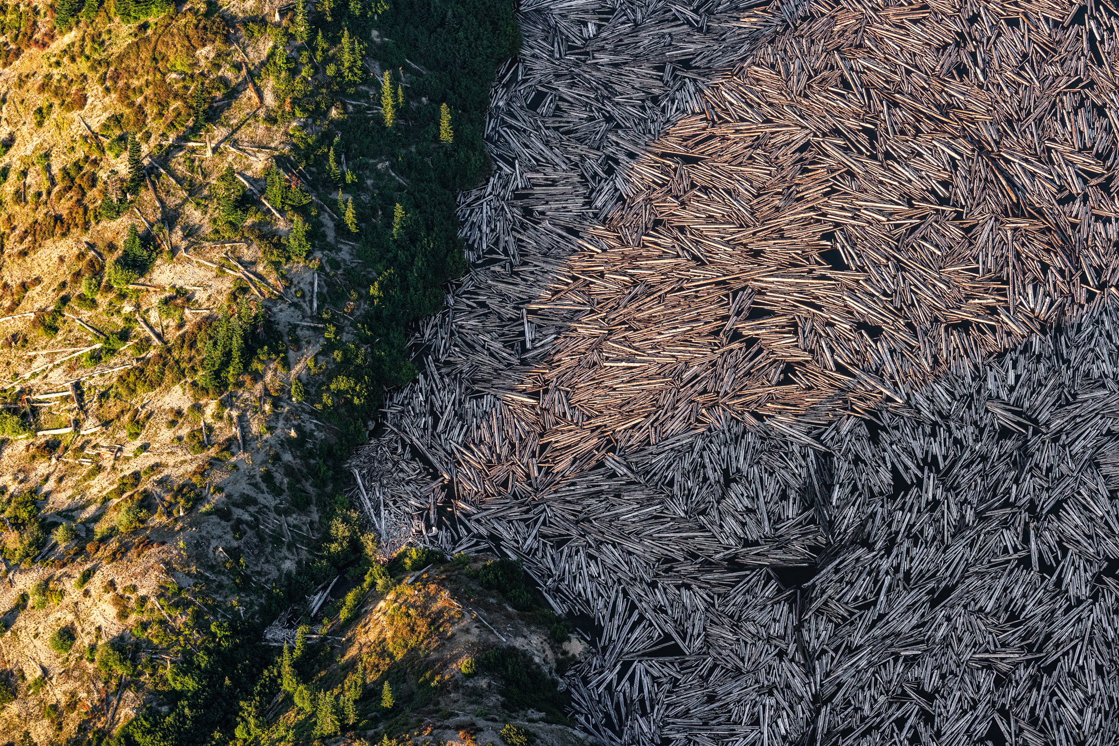
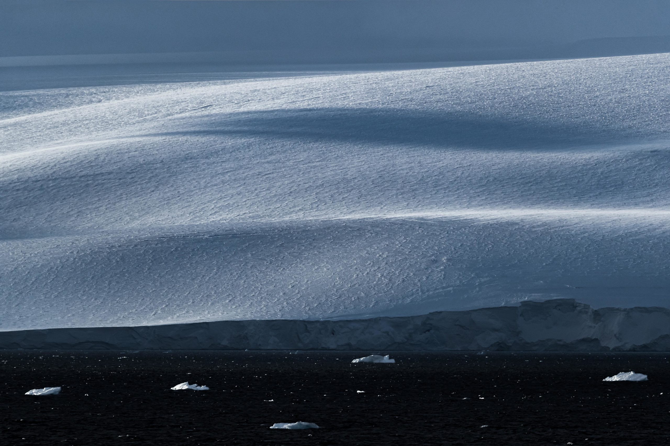
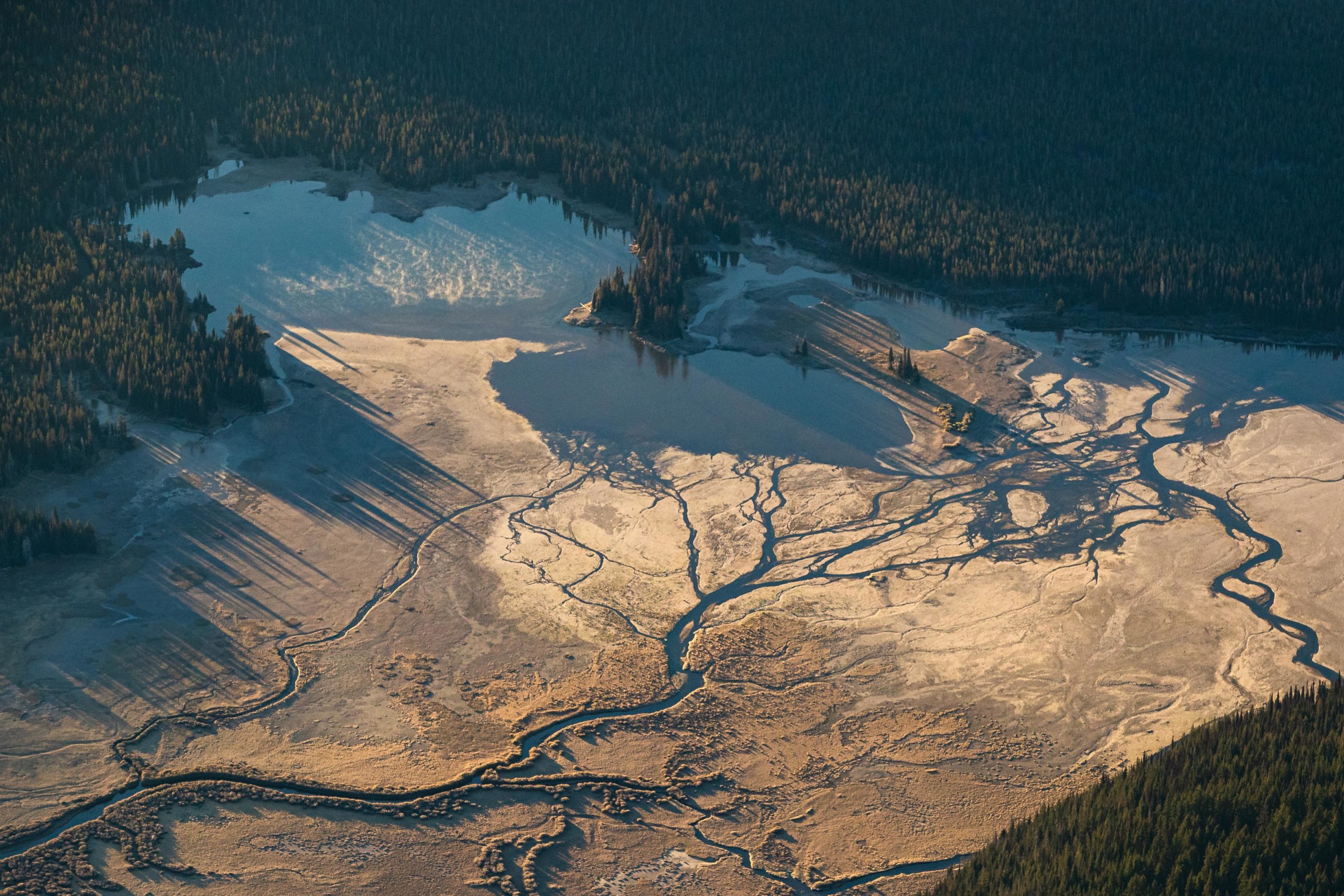
Although difficult to notice at first, a remarkable remanent from the eruption of 1980 can still be seen today…
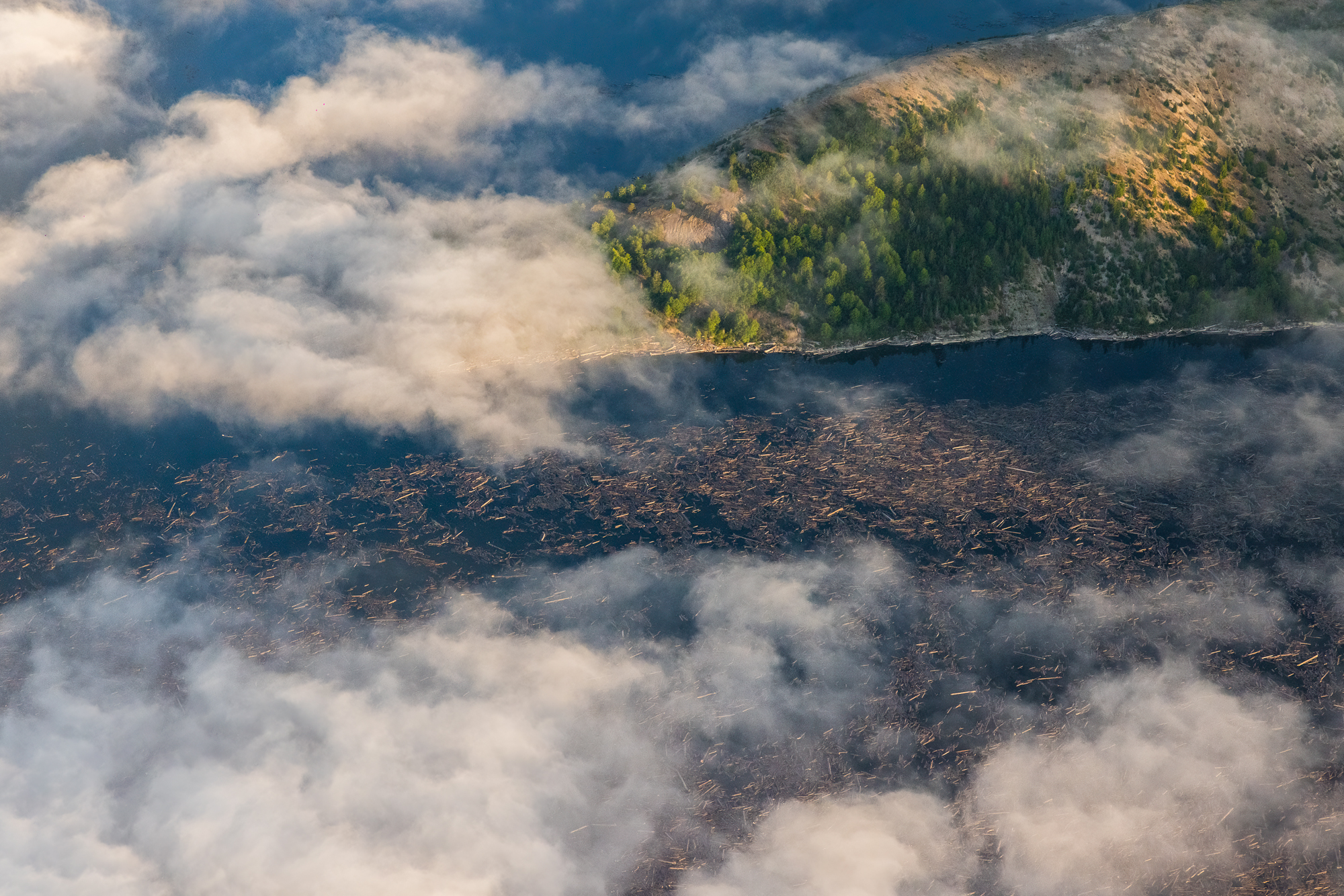
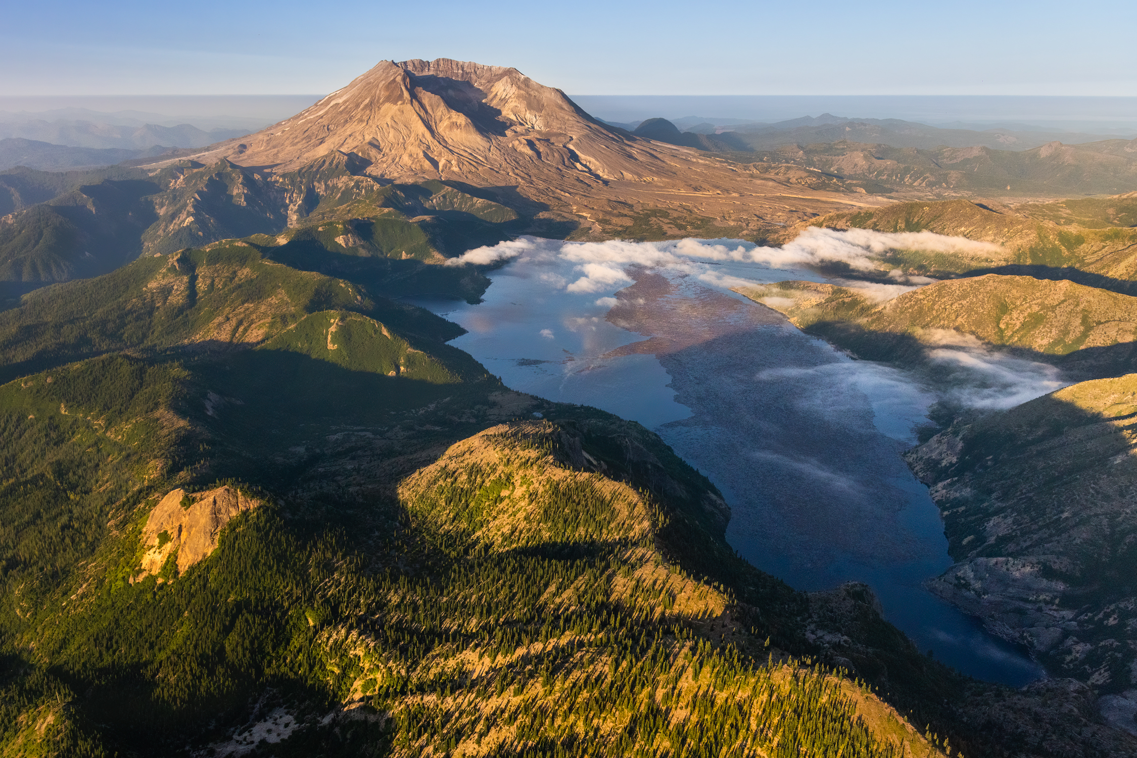
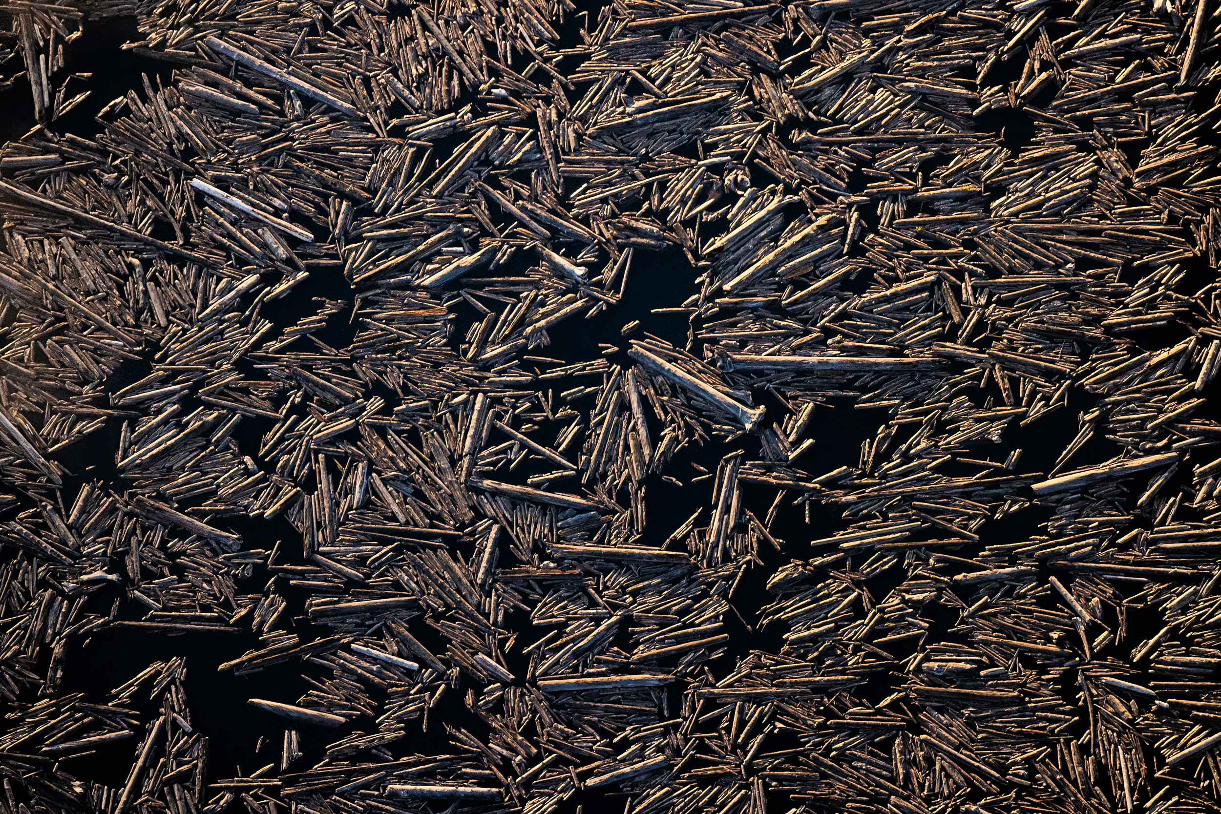
Upon closer inspection, what may appear to be an island or a shallow stretch of muddy lake is actually thousands upon thousands of trees floating in the water. During Mount St Helen’s eruption in 1980, these trees were all blasted from the surrounding hillsides and all plunged into Spirit Lake.
When viewed from above, the scale of these floating trees is beyond breathtaking…
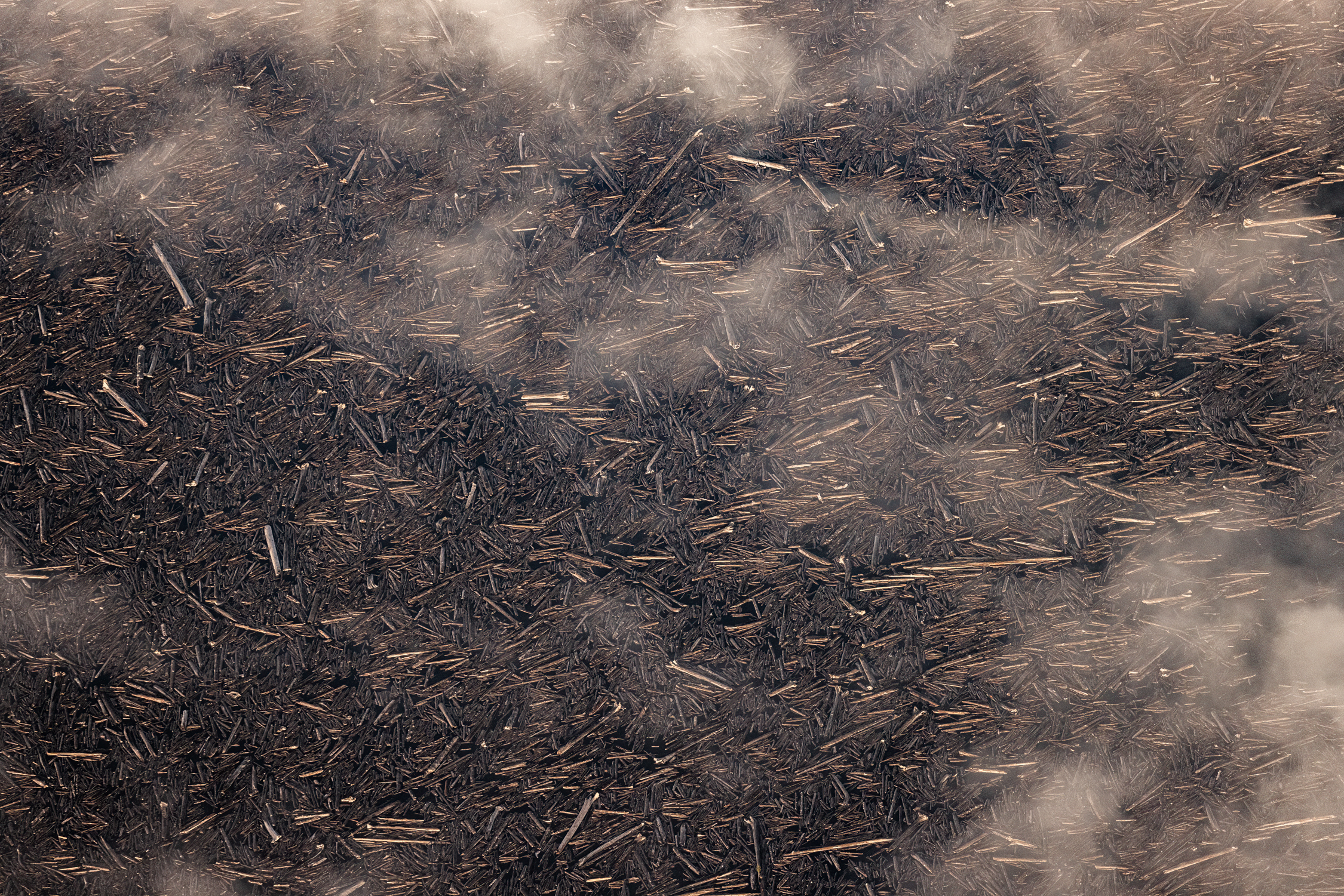
It’s estimated that over a million trees float in Spirit Lake today.
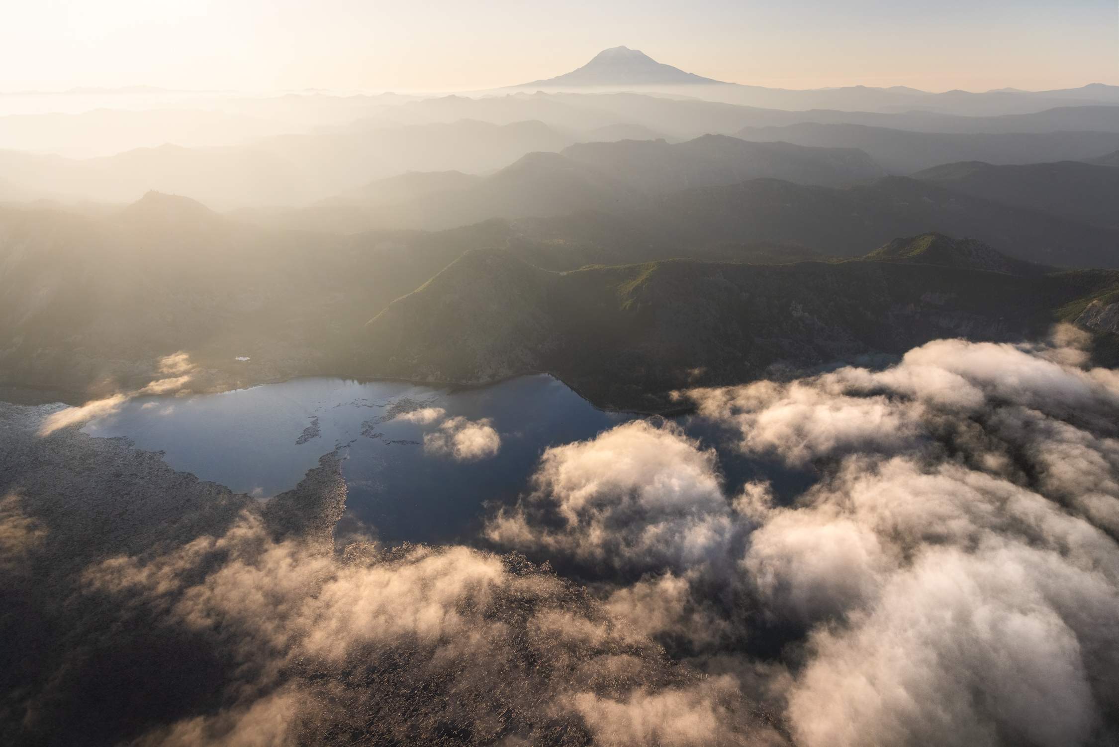
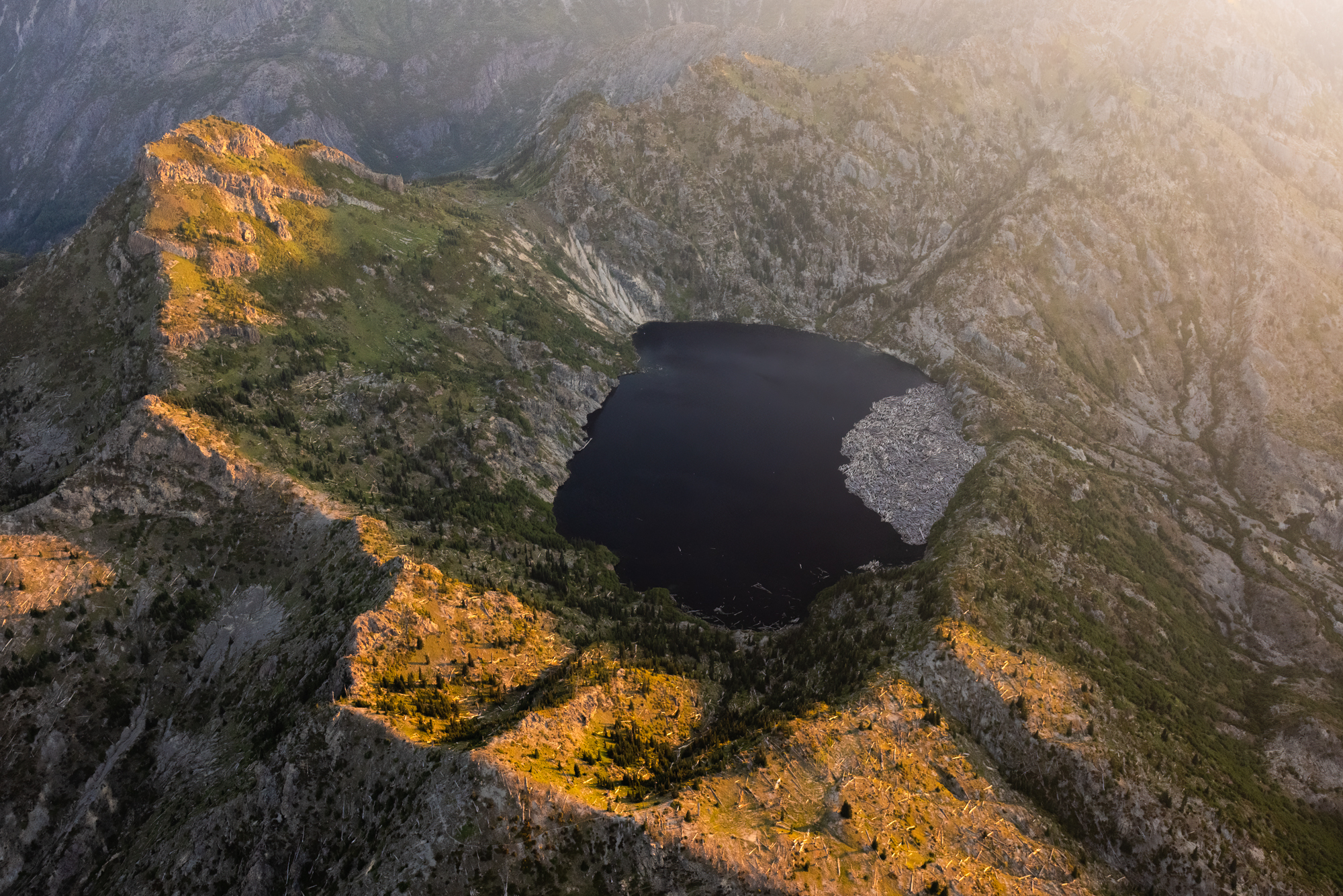
Despite being significantly smaller than Spirit Lake, Saint Helens Lake is also home to a fair amount of floating trees. I particularly enjoyed the way this ‘island’ of trees looked from above.
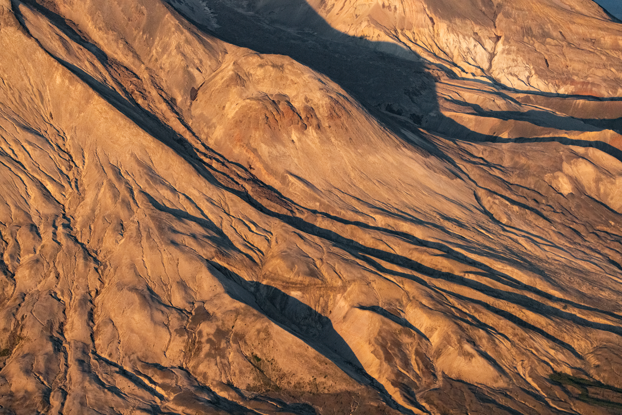
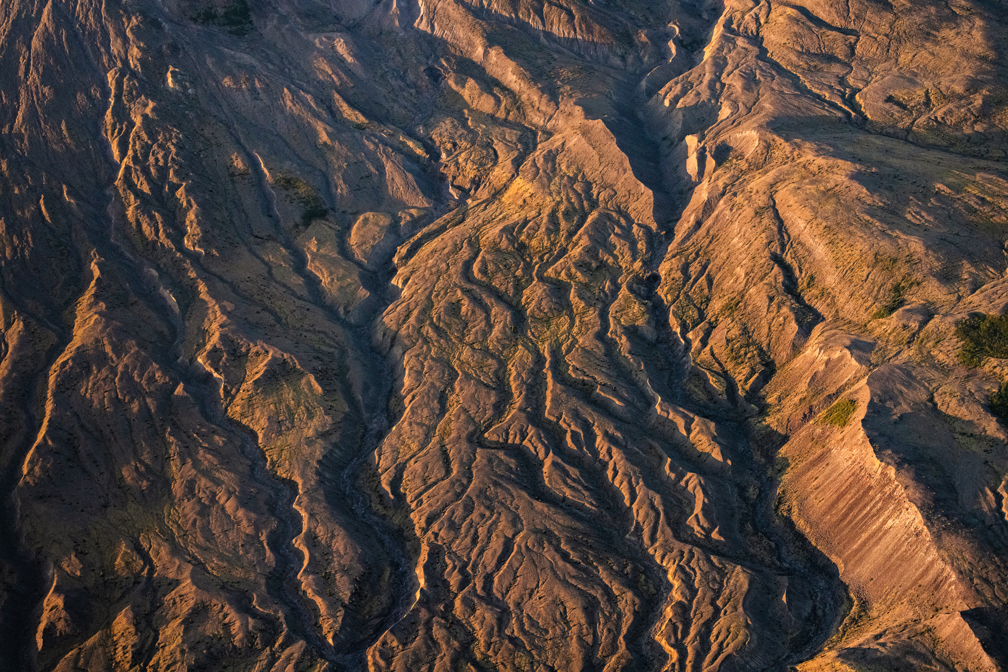
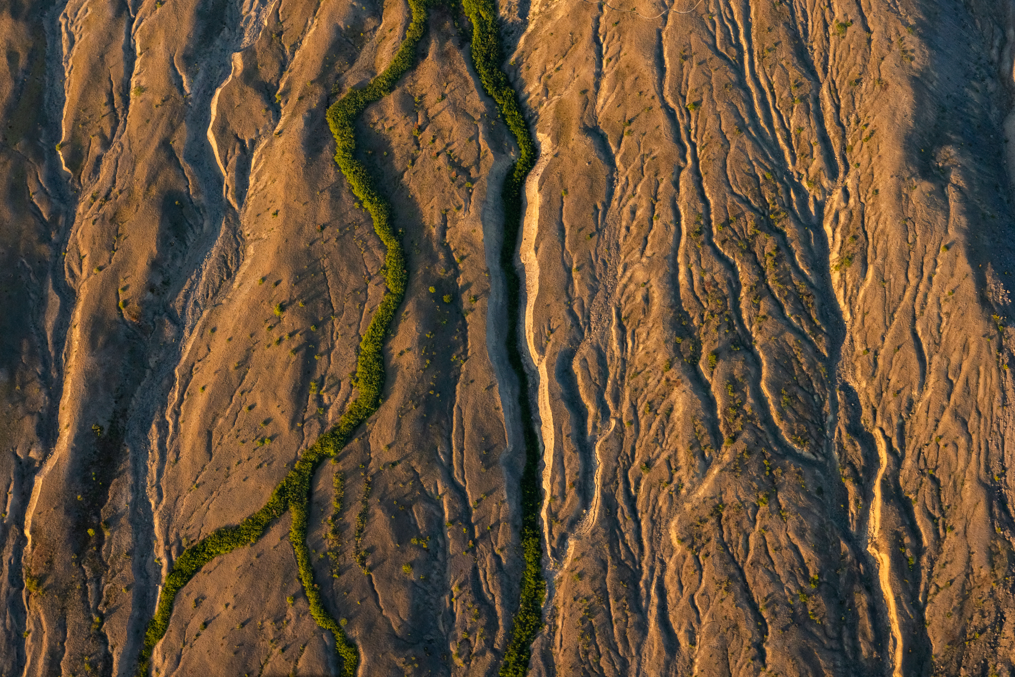
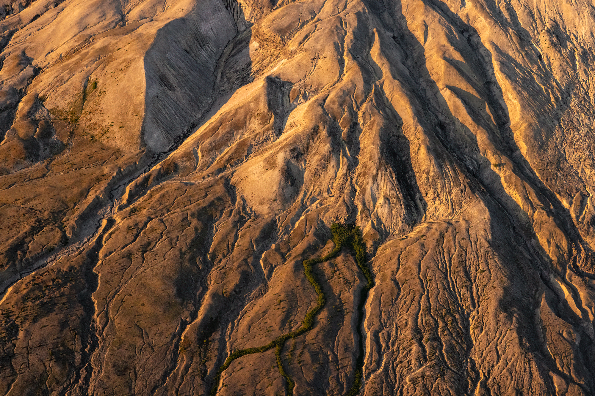
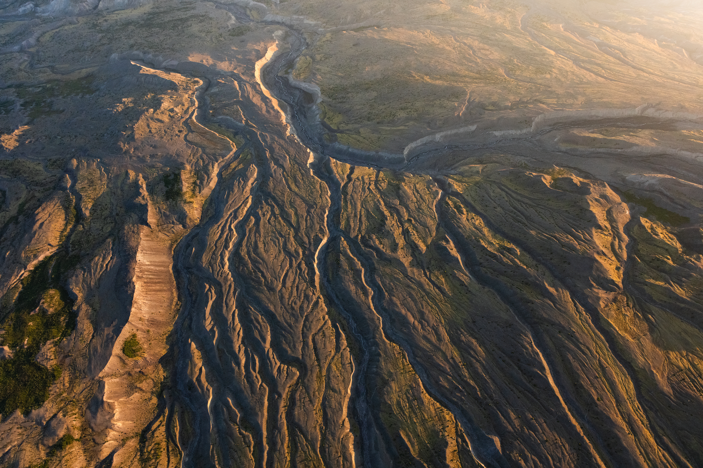
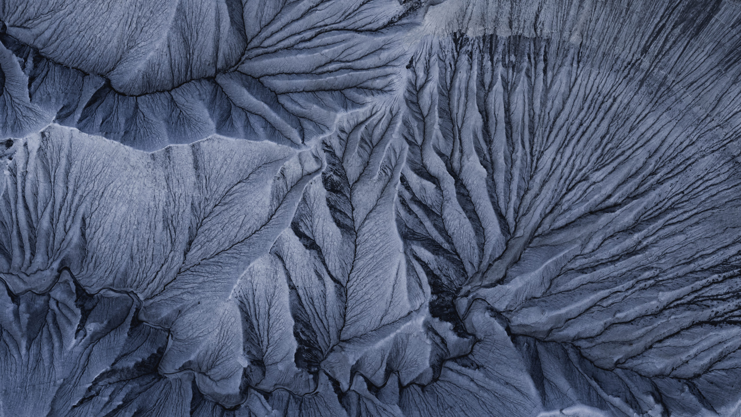
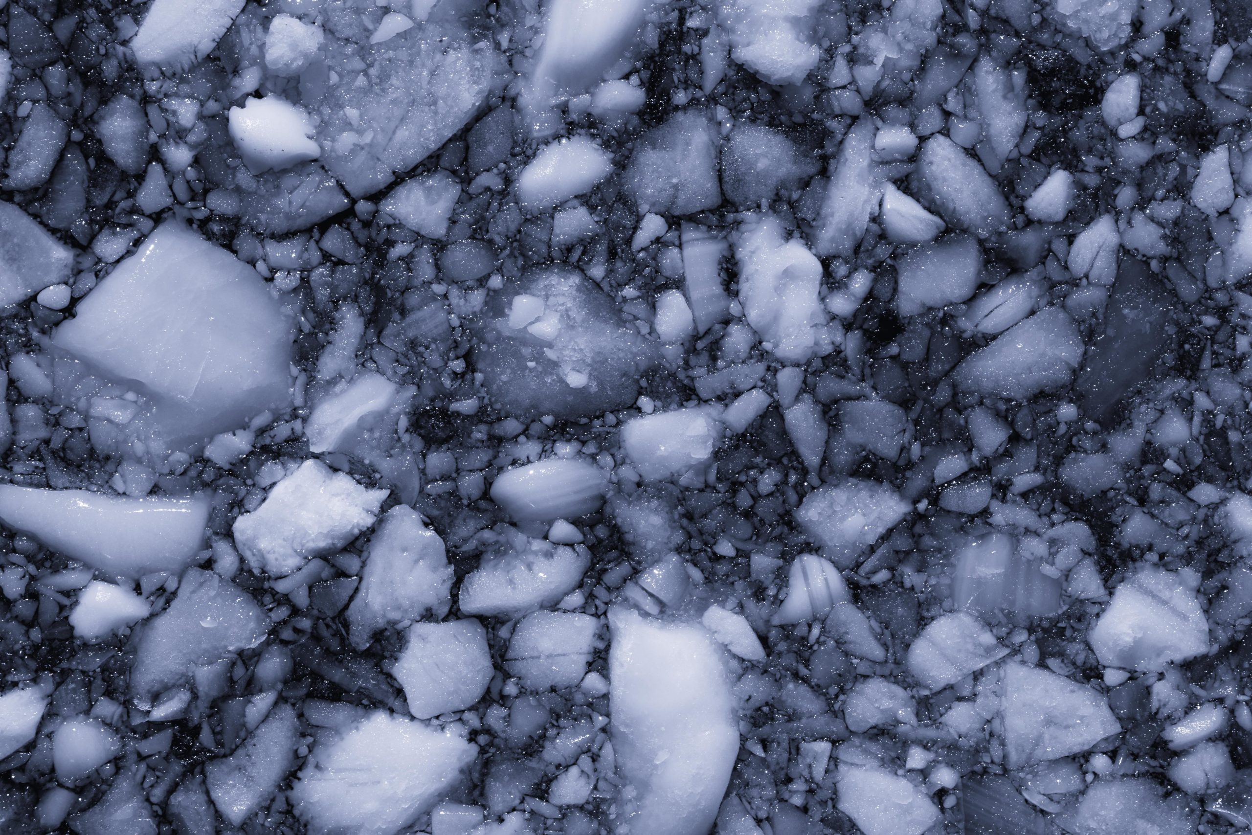
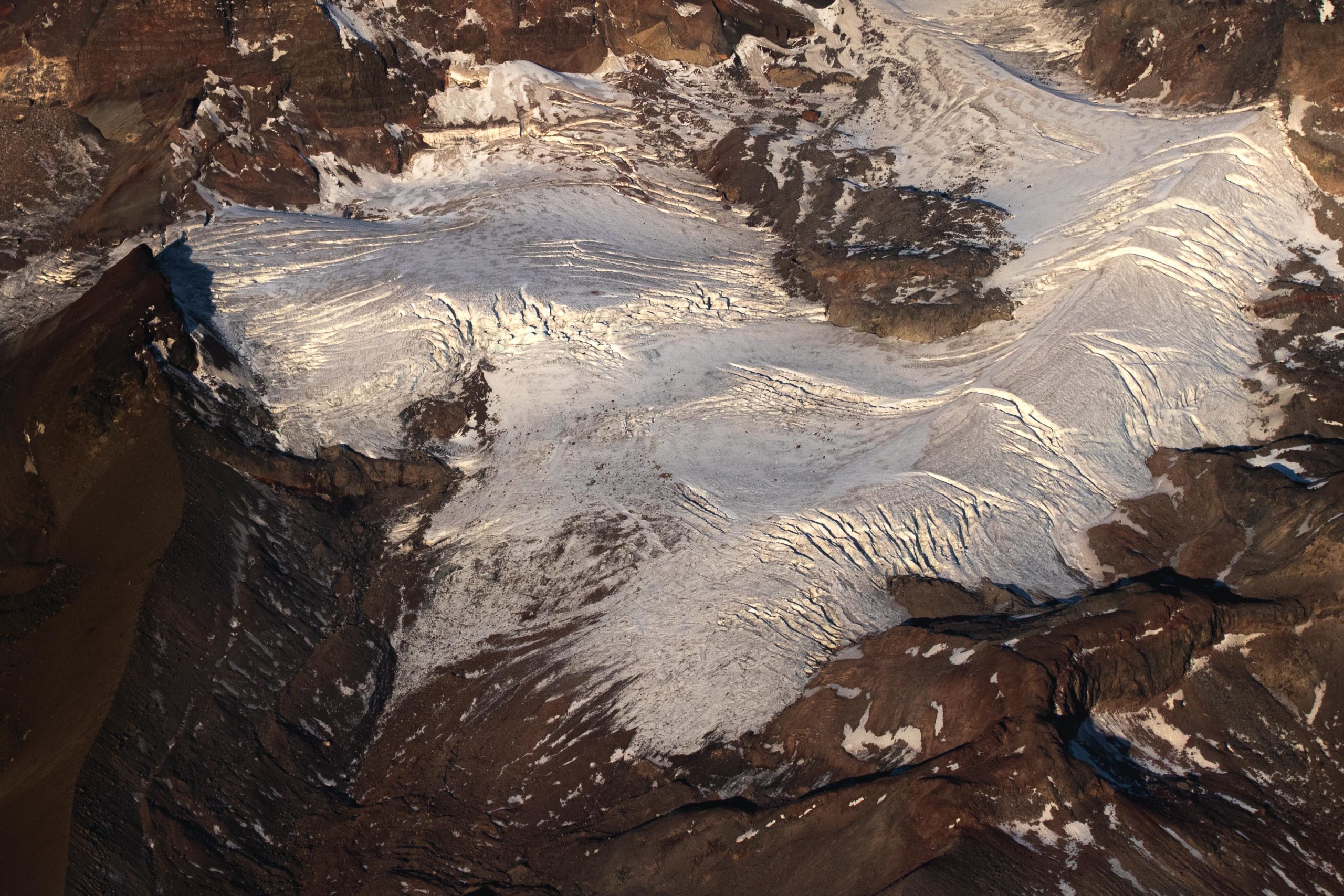
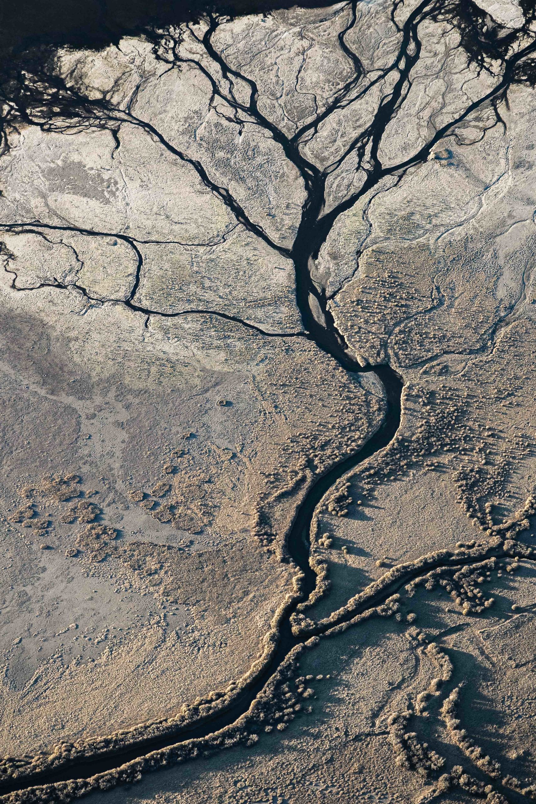
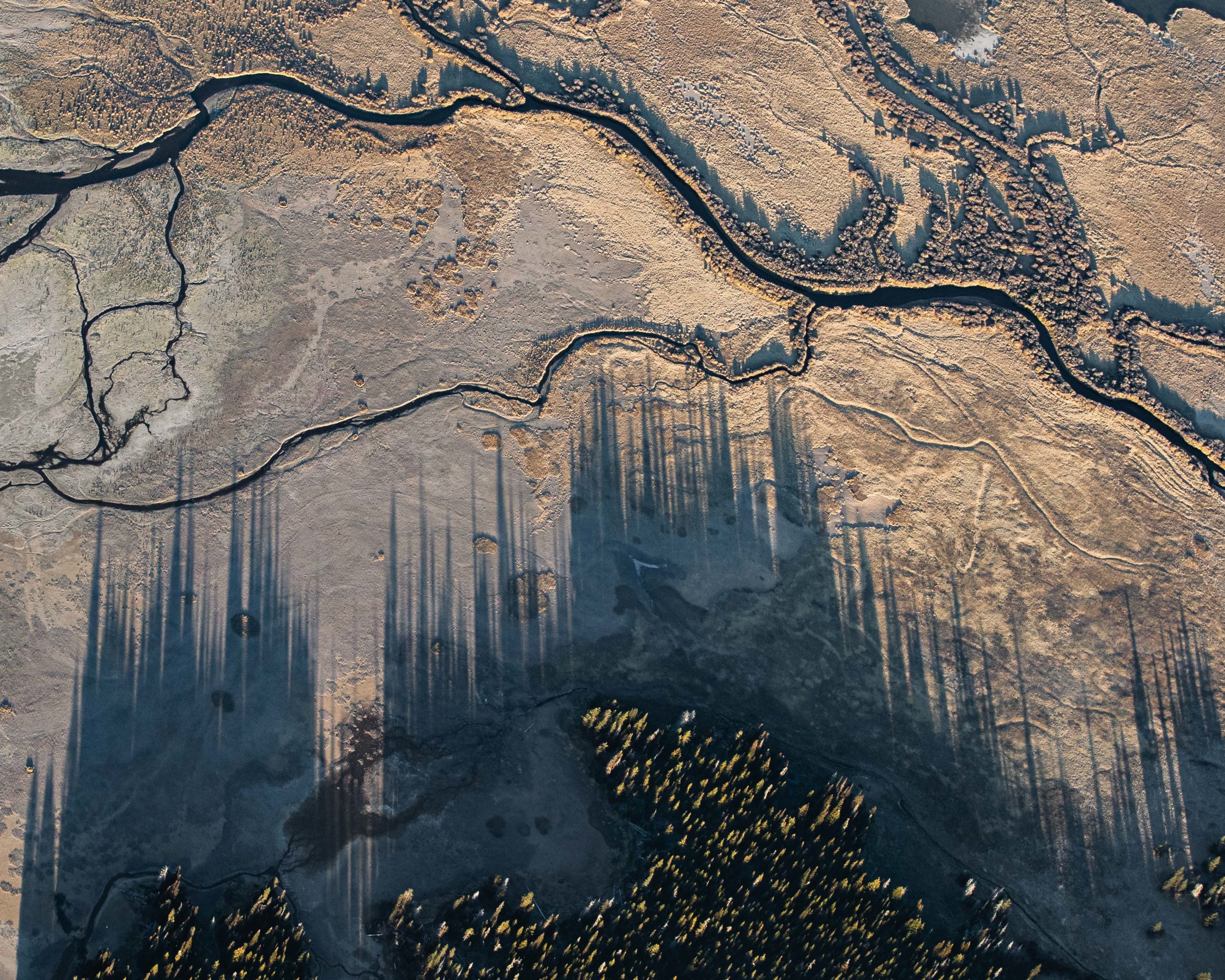
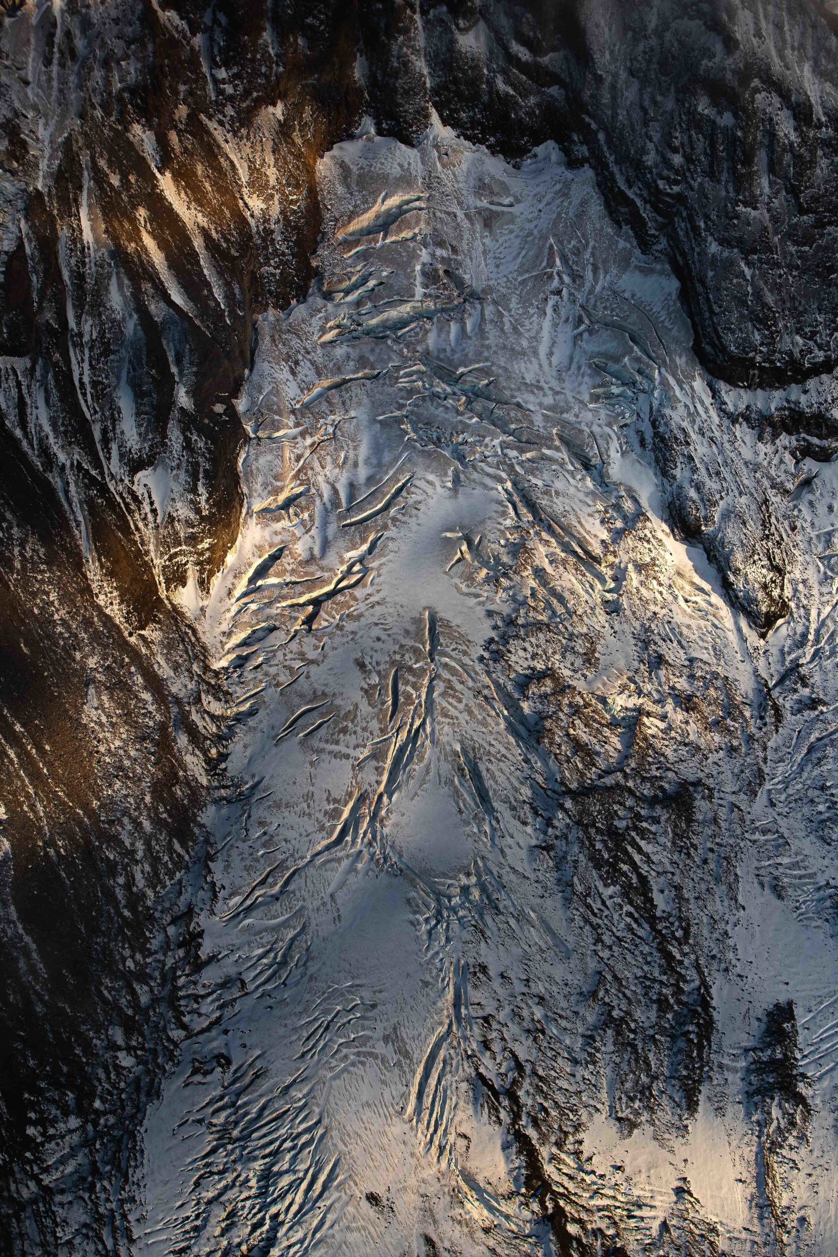
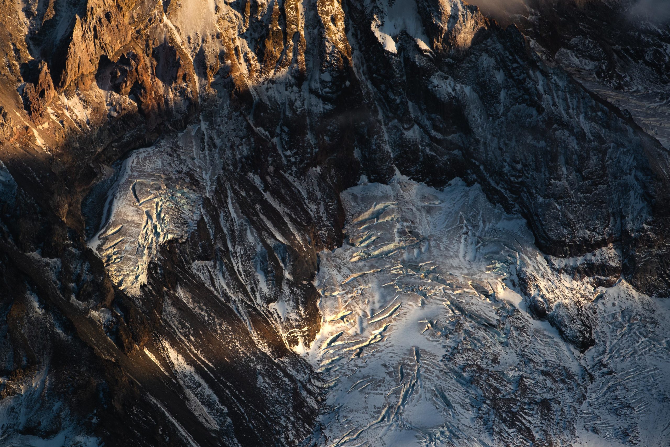
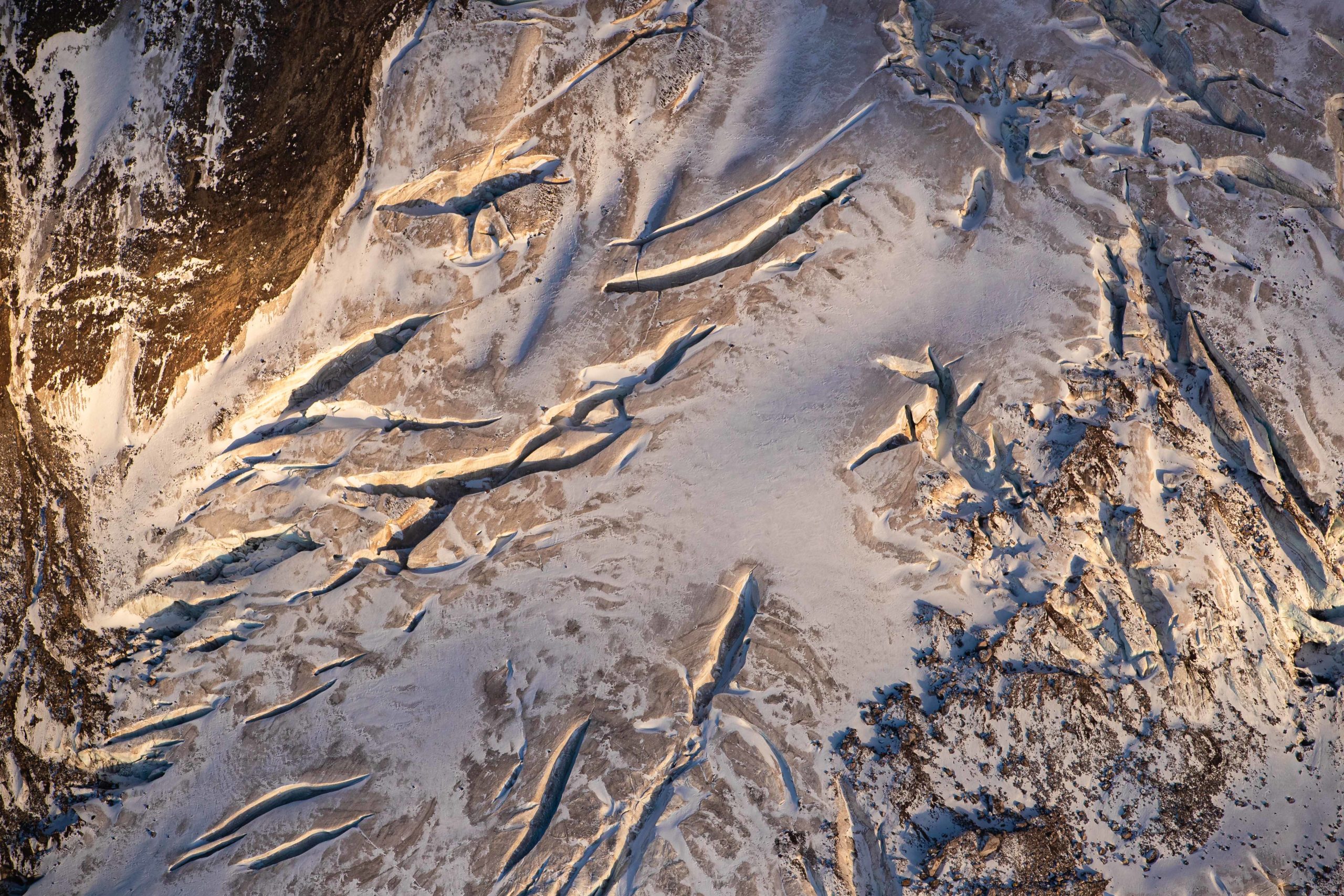
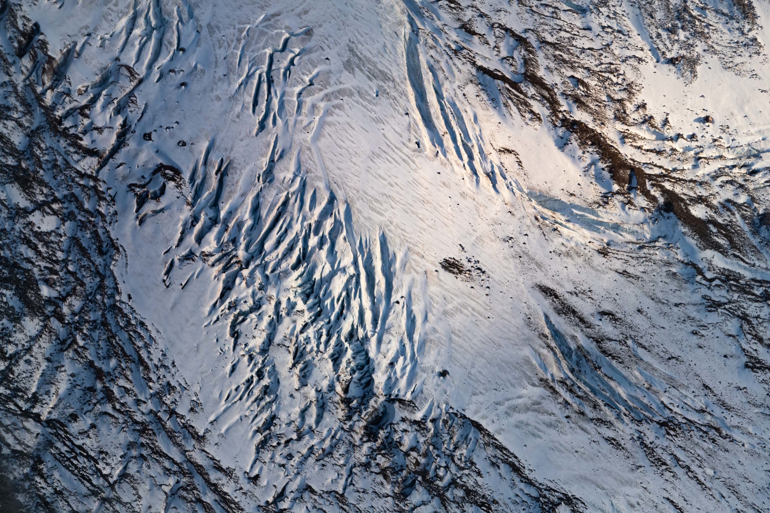
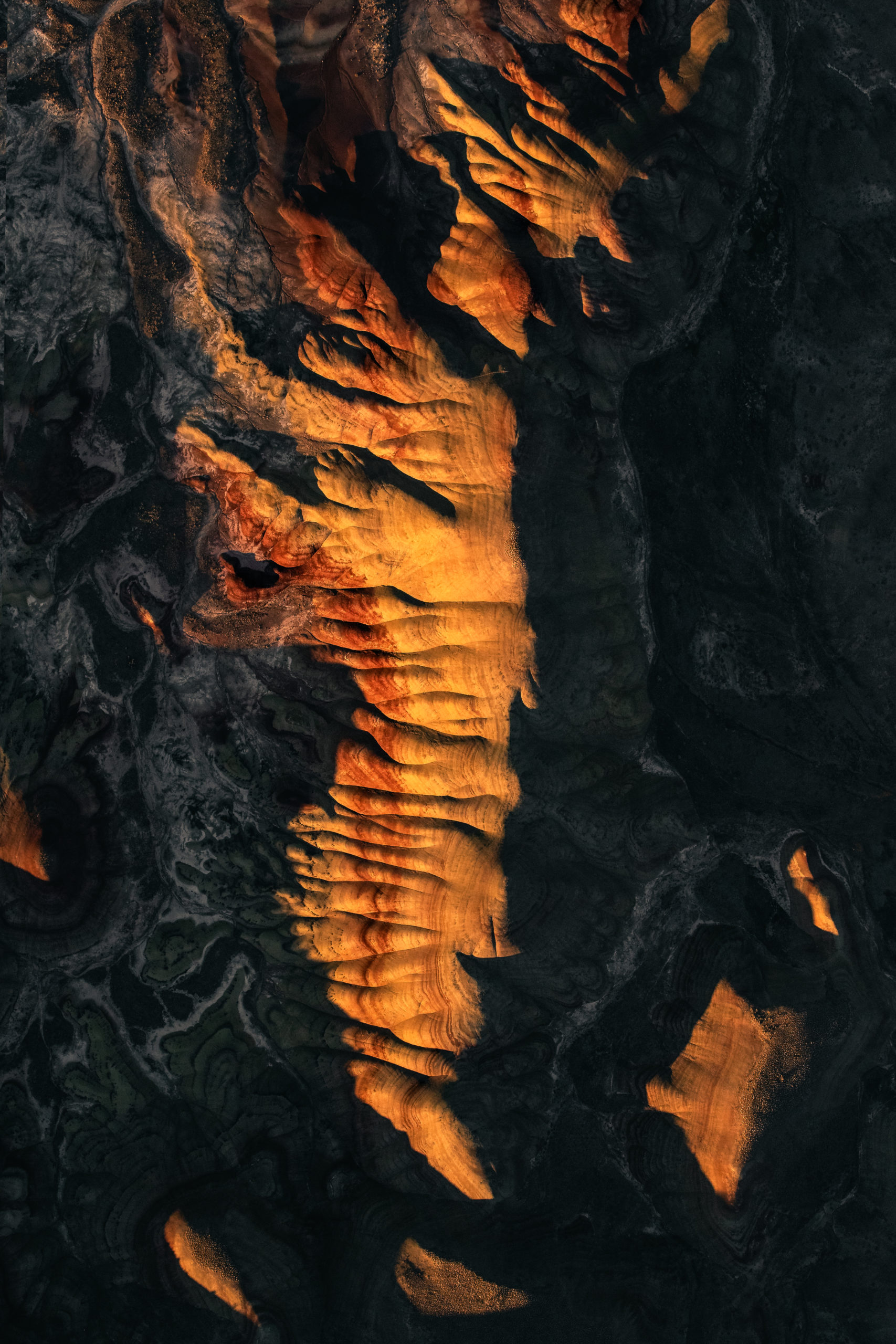
Another remanent in the landscape on Mount St Helens is it’s intricate and unique patterns carved out from the flows of debris during the volcanic eruption. These flows of debris are known as ‘lahar’ and are best viewed from an aerial perspective.
These landscape features begin on Mount St Helens itself and can be traced downwards to the base of the mountain. Lahar flows on Mount St Helens even continue all the way into the surrounding landscape. Photographing these abstract textures from the airplane was incredible!

Related Aerial Photography Post:
Above Oregon's Central Cascades
View a collection of aerial landscape photography captured from a small aircraft over Broken Top Mt, Three Finger Jack, Mt Jefferson, Mt Washington and the Sisters mountains.
Related Aerial Photography Post:
Above Mt Hood, Oregon
View a collection of aerial landscape photography images of Oregon’s Mount Hood during sunset.

Related Aerial Photography Post:
Aerial Photography: The High-Lights
View Andrew Studer’s complete collection of aerial photography captured from drones, airplanes and helicopters all around the world.
Related Aerial Photography Post:
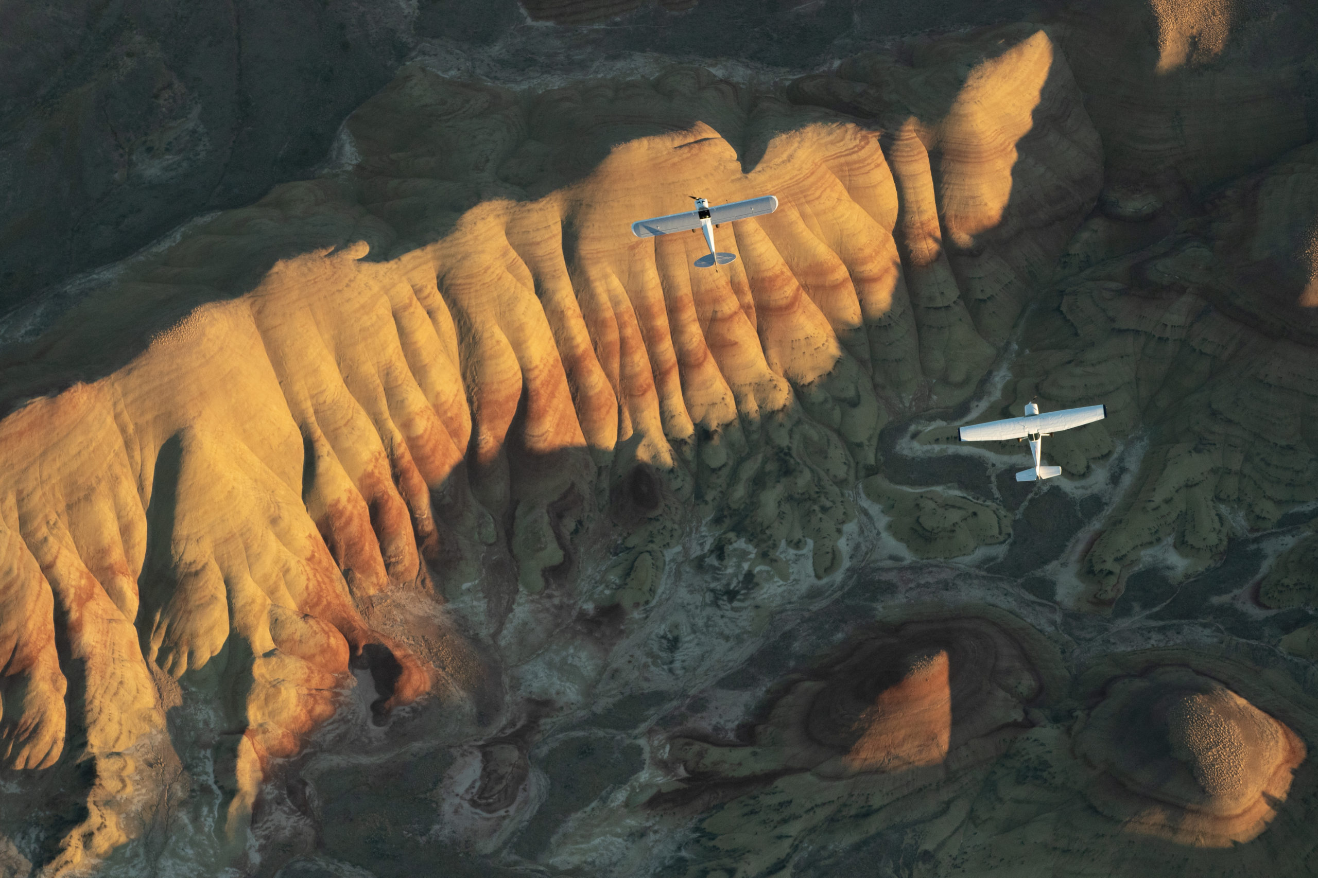
Aviation Photography Over Oregon
Andrew and a team of pilots set out to capture an image of two airplanes flying over Oregon’s Painted Hills. View a gallery of images and watch a ‘behind the scenes’ documentary covering the photoshoot.
Abstract Landscape Photography
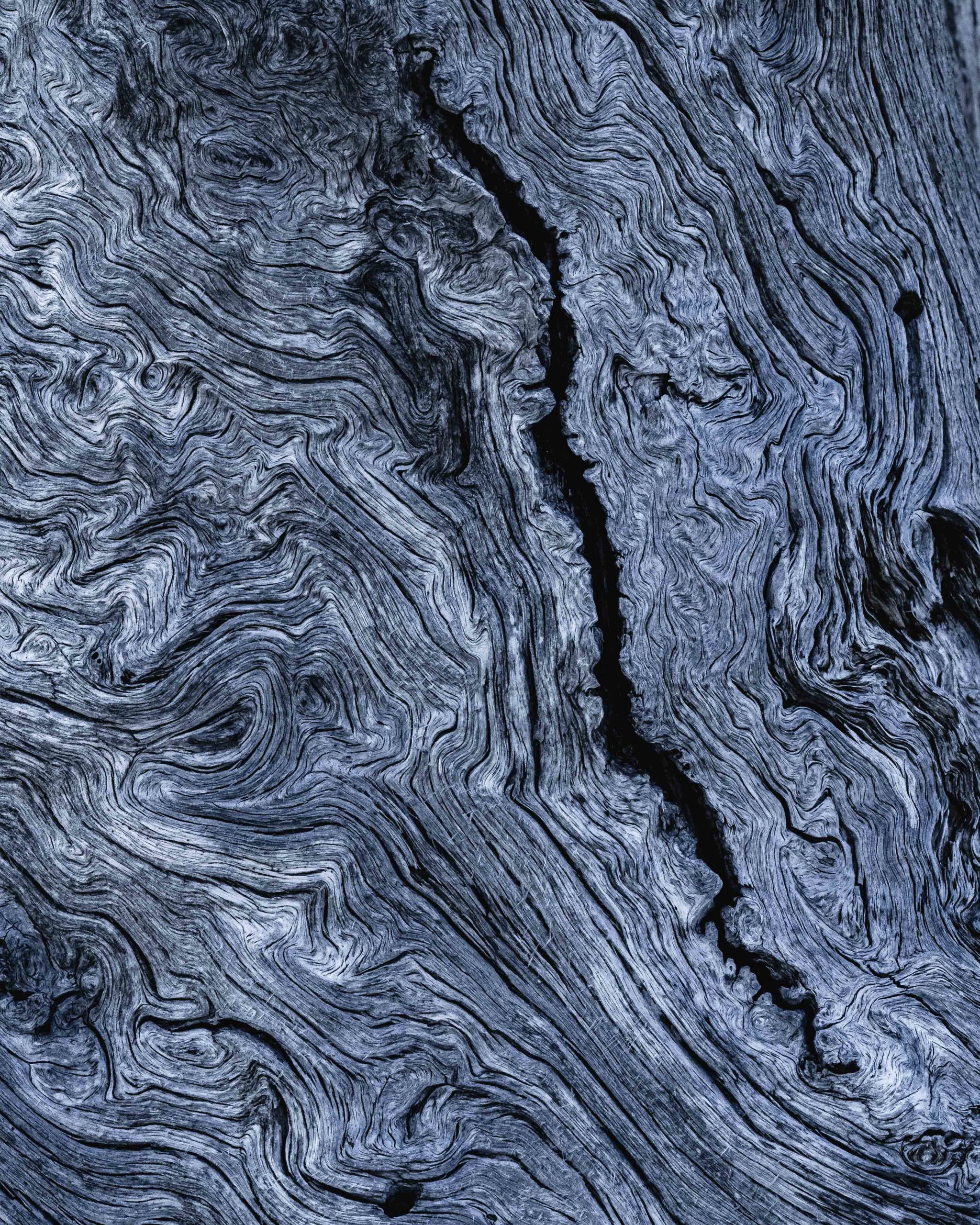
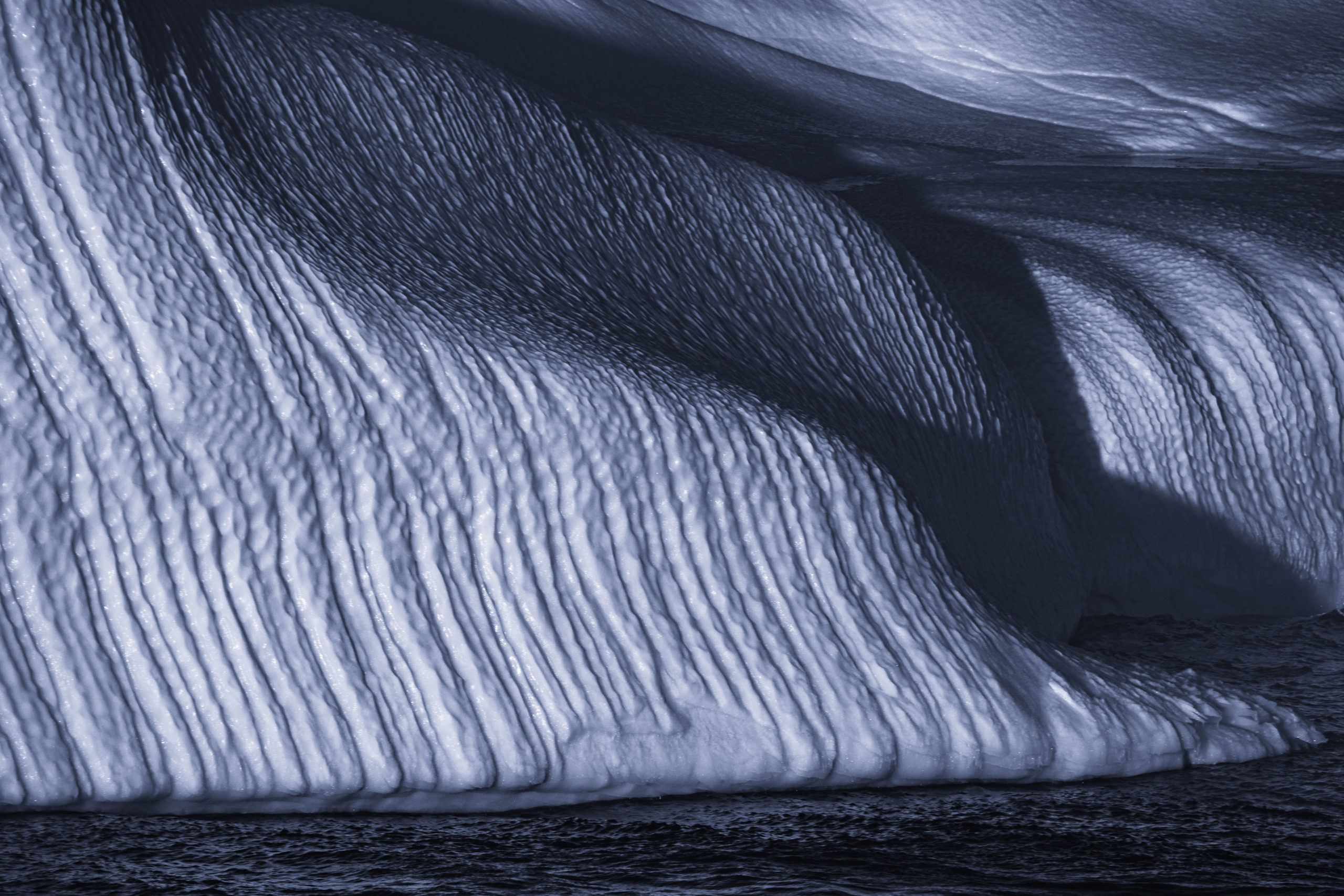
Whether viewing from high above in an airplane or up close with a macro lens, beautiful abstract patterns are found everywhere within landscape photography. One of my favorite ‘techniques’ or ‘exercises’ to keep inspired and in a creative headspace is to keep an eye out for visually abstract patterns while I am photographing in nature. It has become a fun way to challenge myself creatively and push myself to capture what I feel are unique images.

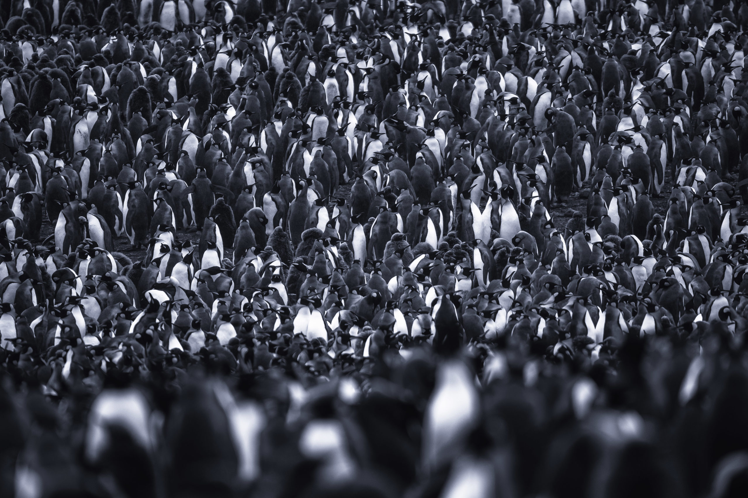
These two abstract images of a large king penguin colony on South Georgia Island were completely unexpected. I shot these using a telephoto lens to compress the penguins together and let the repetition in their bodies be the abstract pattern.

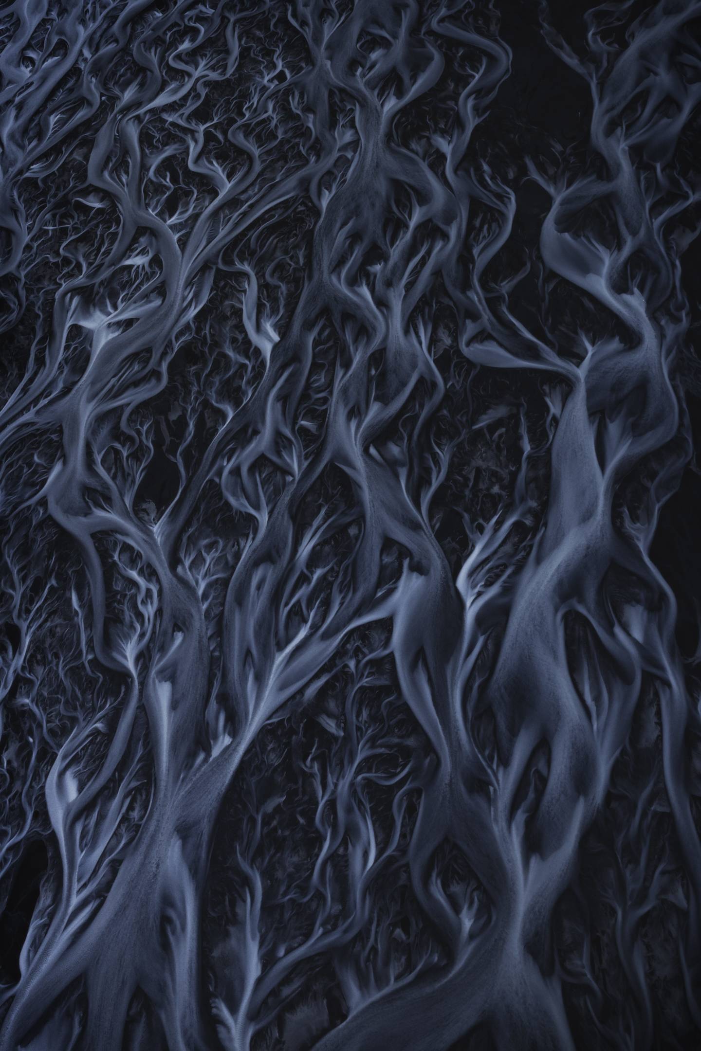
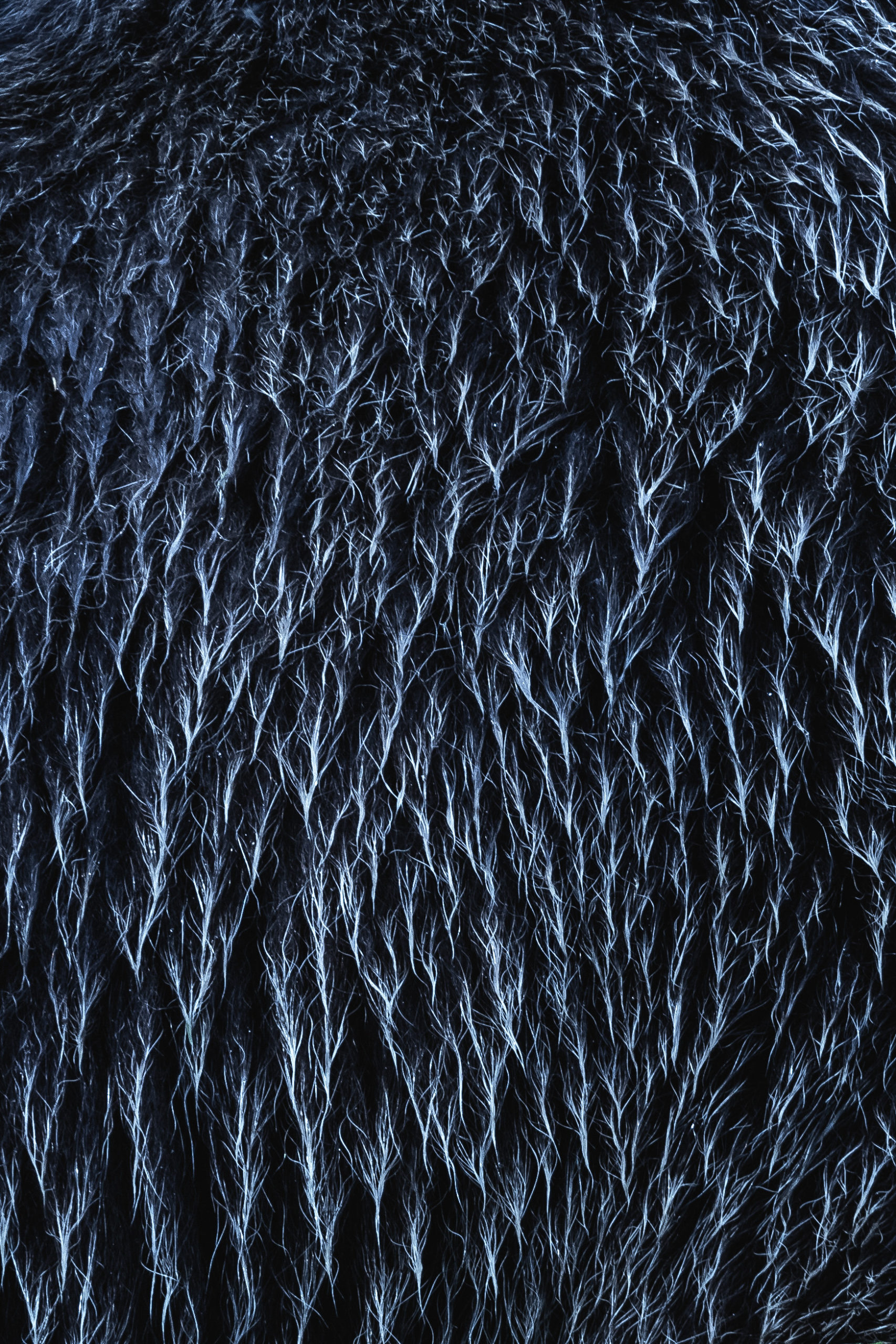
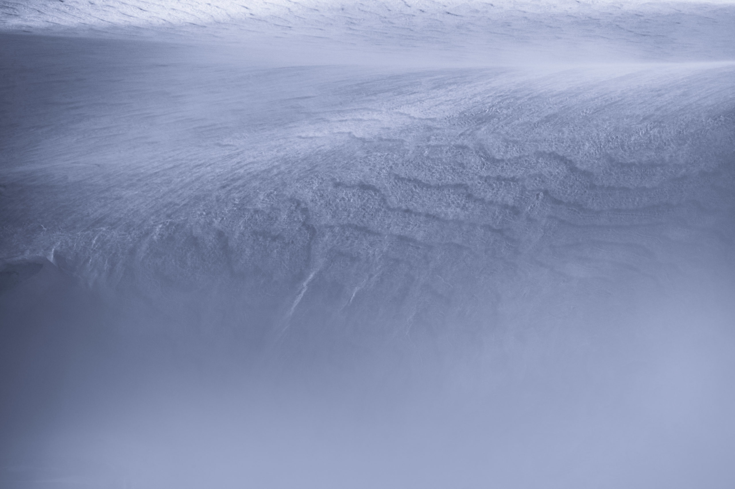
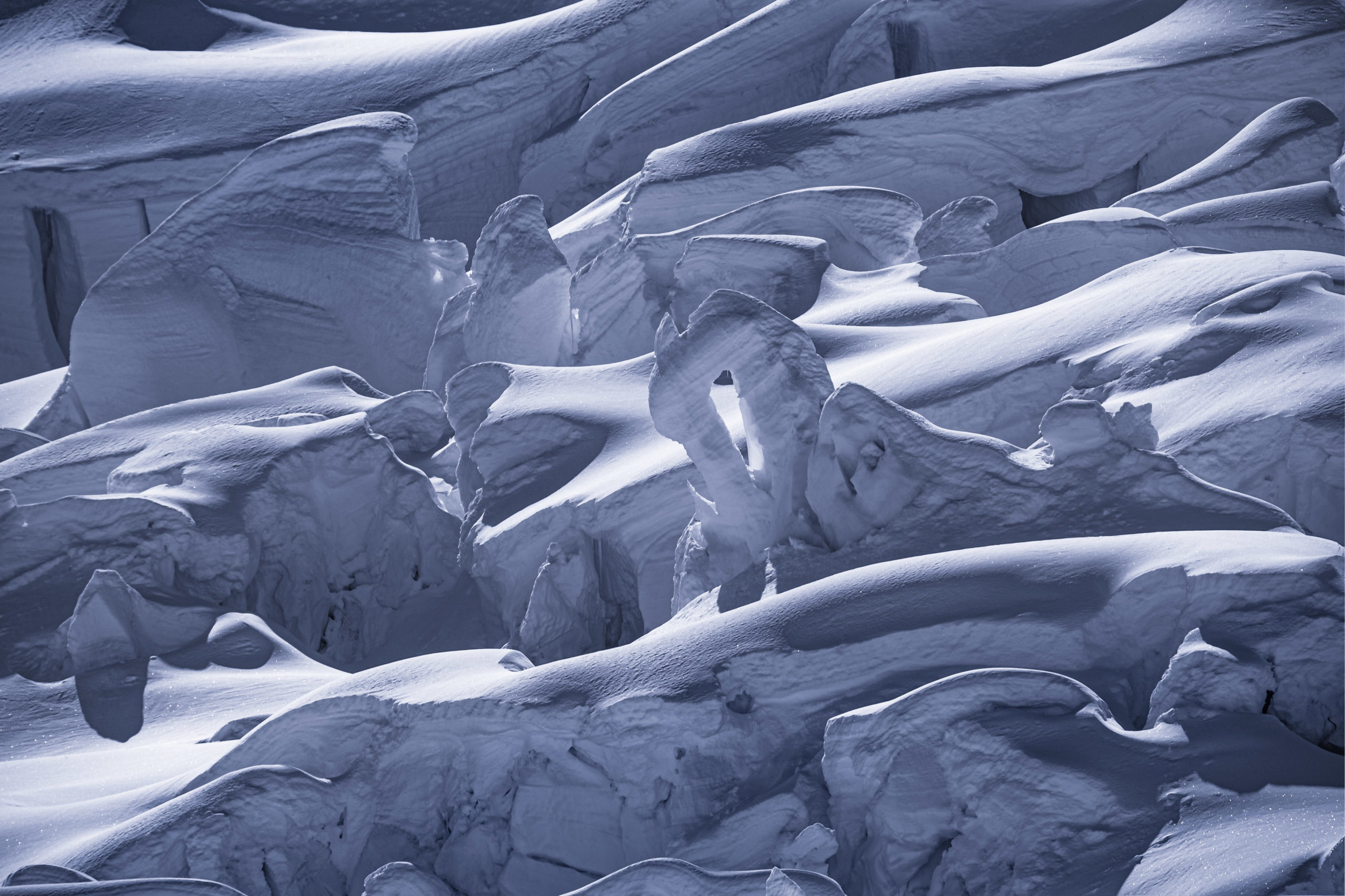
One of my favorite abstract landscape photography images I’ve shot is of Iceland’s glacial streams from high above in an airplane. As the glacial melt flows out into various streams, they become braided and create the most intricate patterns I’ve ever seen. Several years after photographing the glacial streams in Iceland, I shot a closeup photo of a bear’s fur. I like sharing these images side by side because to me, they have a very similar pattern and the bear’s fur is hard to recognize at first.


Central Oregon Mountains Aerial Photography
After a successful aerial landscape photography photoshoot on Mount Hood at sunset, we flew east towards Central Oregon with plans to photograph the Cascade Mountain Range at sunrise.
Over the years, I have spent a fair amount of time exploring and photographing the beautiful mountains near Bend, Oregon. Some of my favorite memories over the past few summers were made adventuring throughout the Three Sisters Mountain Range, Broken Top, Three Finger Jack, Mt Washington as well as Mount Jefferson.
Seeing these mountains from above was truly a dream come true and helped me to fully appreciate more of the rugged wilderness that I’ve yet to explore on foot.
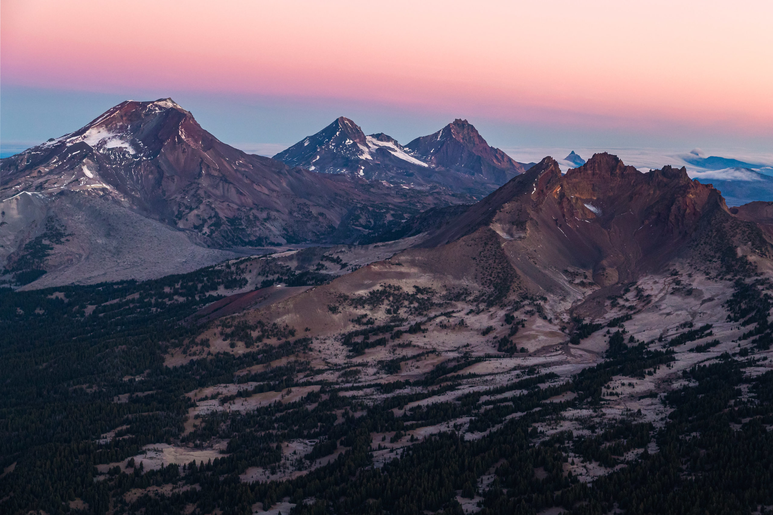
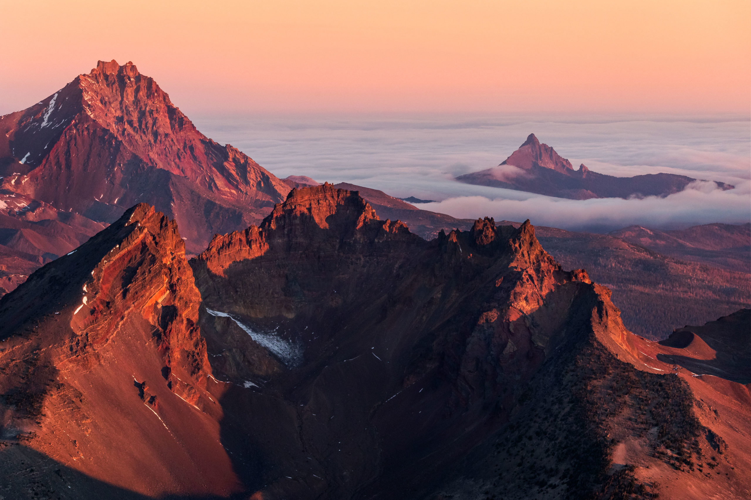
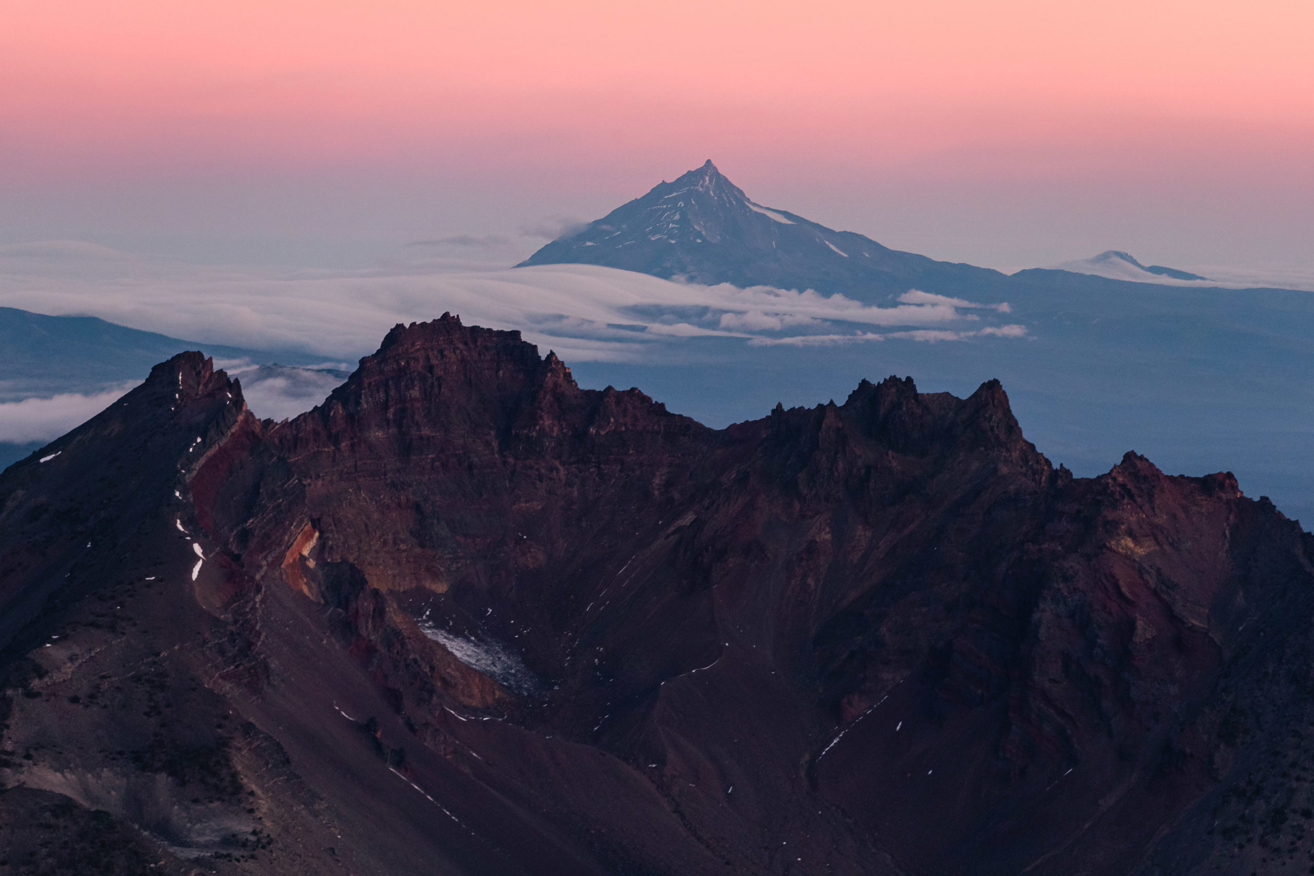
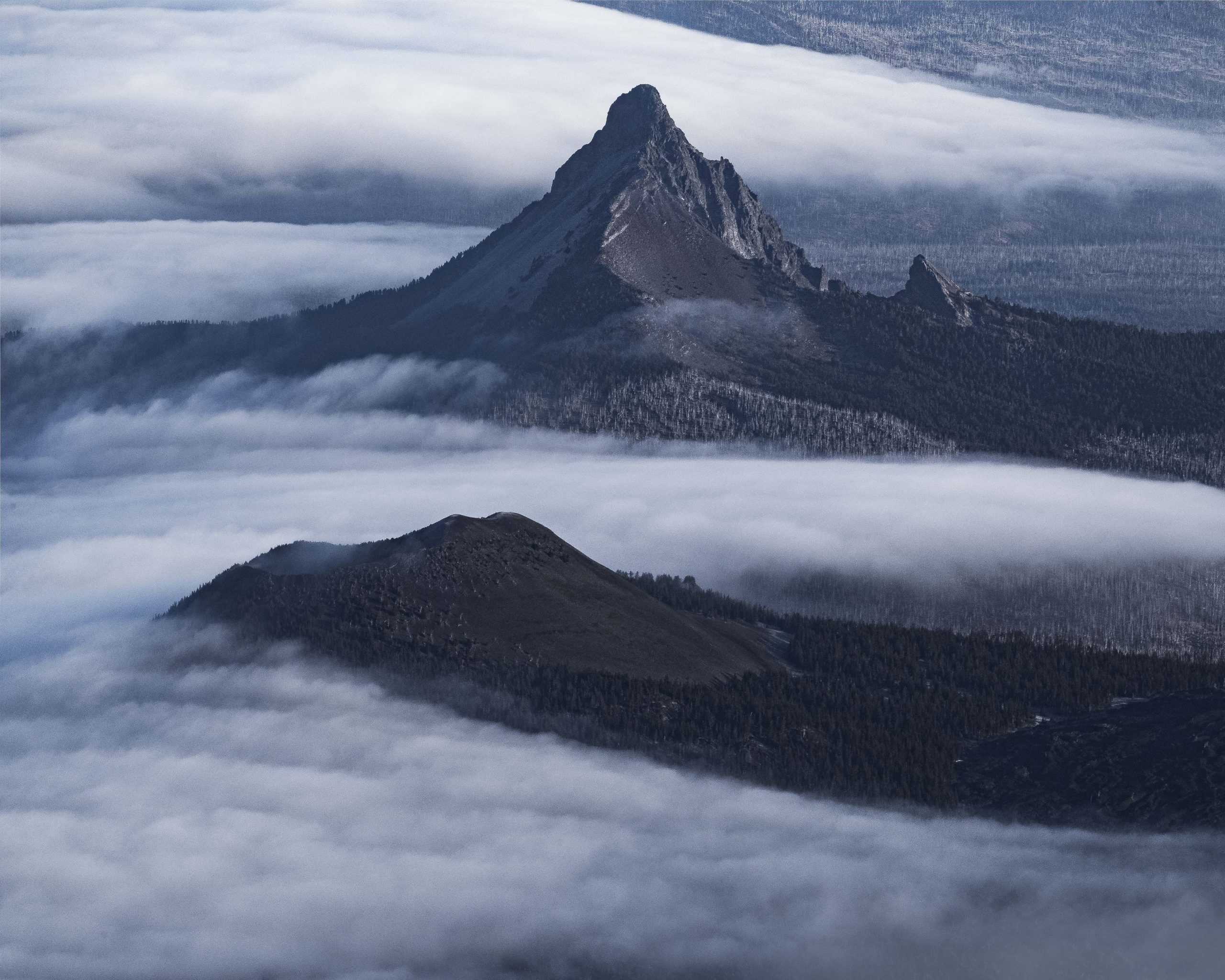
As we approached the mountain range, the pink band of the earth’s shadow began to appear and slowly reach the horizon marking the start of sunrise. I shot this wide aerial image of Broken Top Mountain in front of the Sisters Range with Mount Washington and Three Finger Jack in the distance. It’s incredible how many mountains fit into a single frame. After photographing this wide image, I quickly realized that using a telephoto lens and compressing the mountains together would be my preferred method for this shoot.
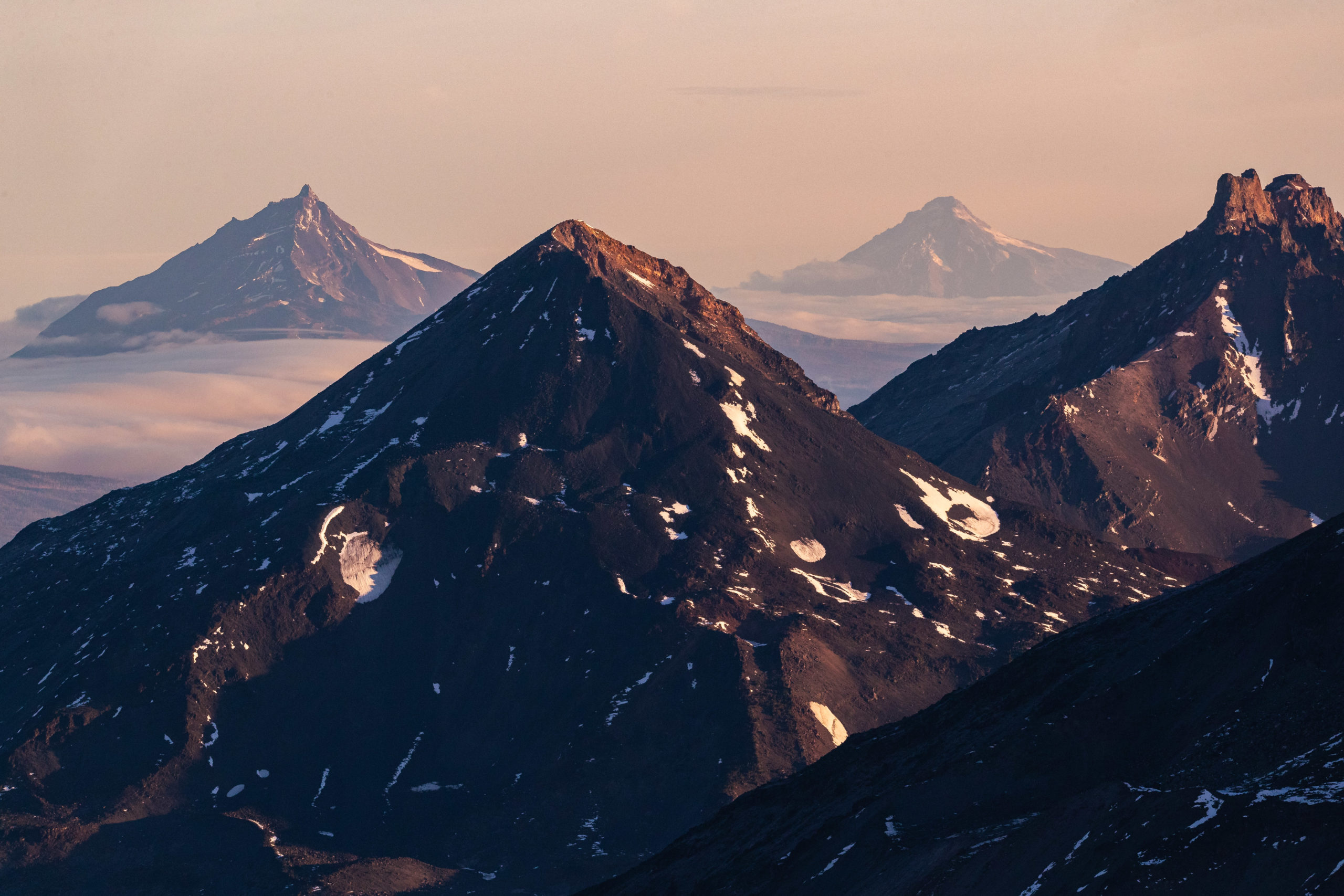
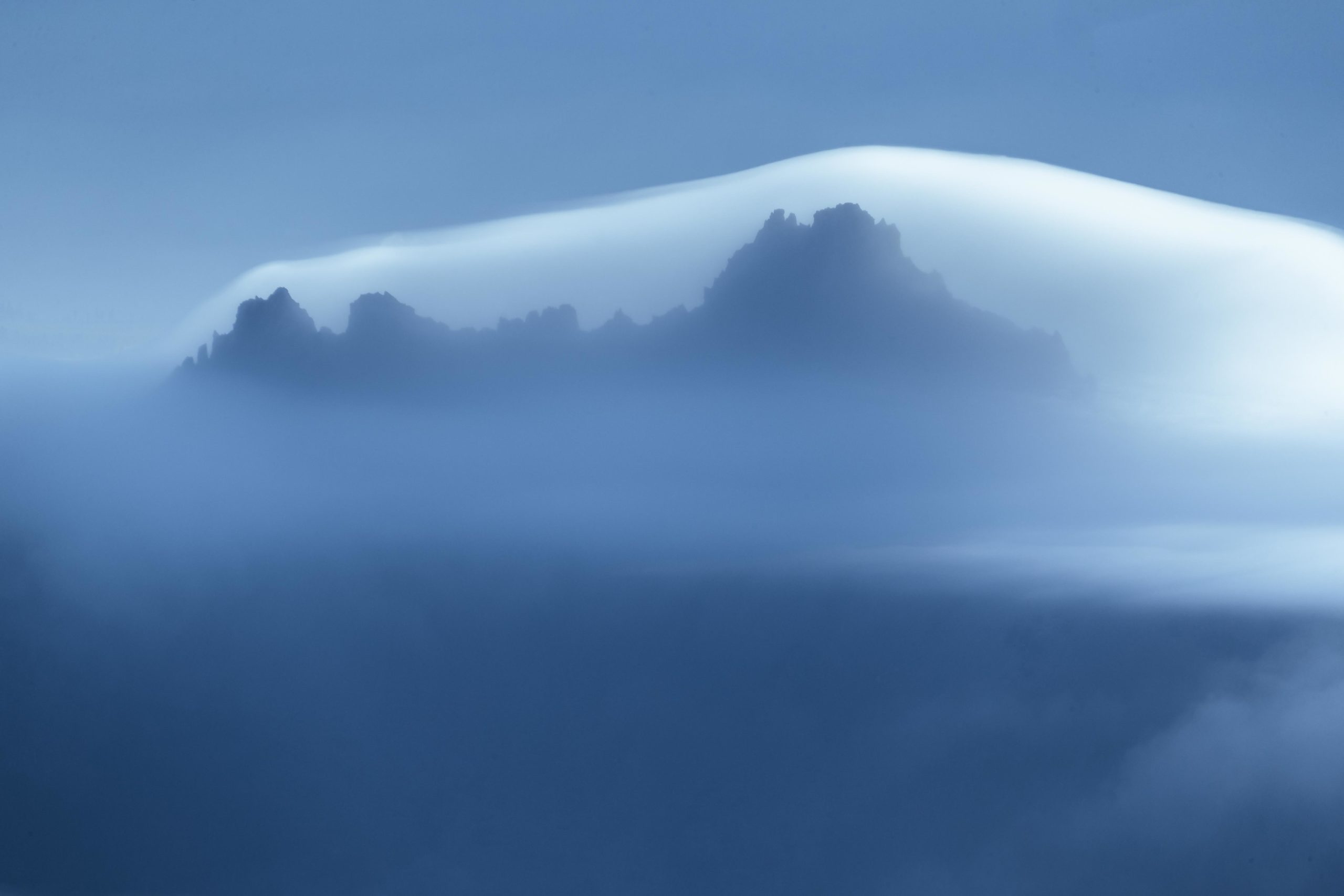
Shortly after putting on my 600mm lens, I realized that capturing closeups of the various mountains in front of each-other was something I had not seen done before. I was filled with inspiration to showcase the jagged peaks with other mountains in the distance.
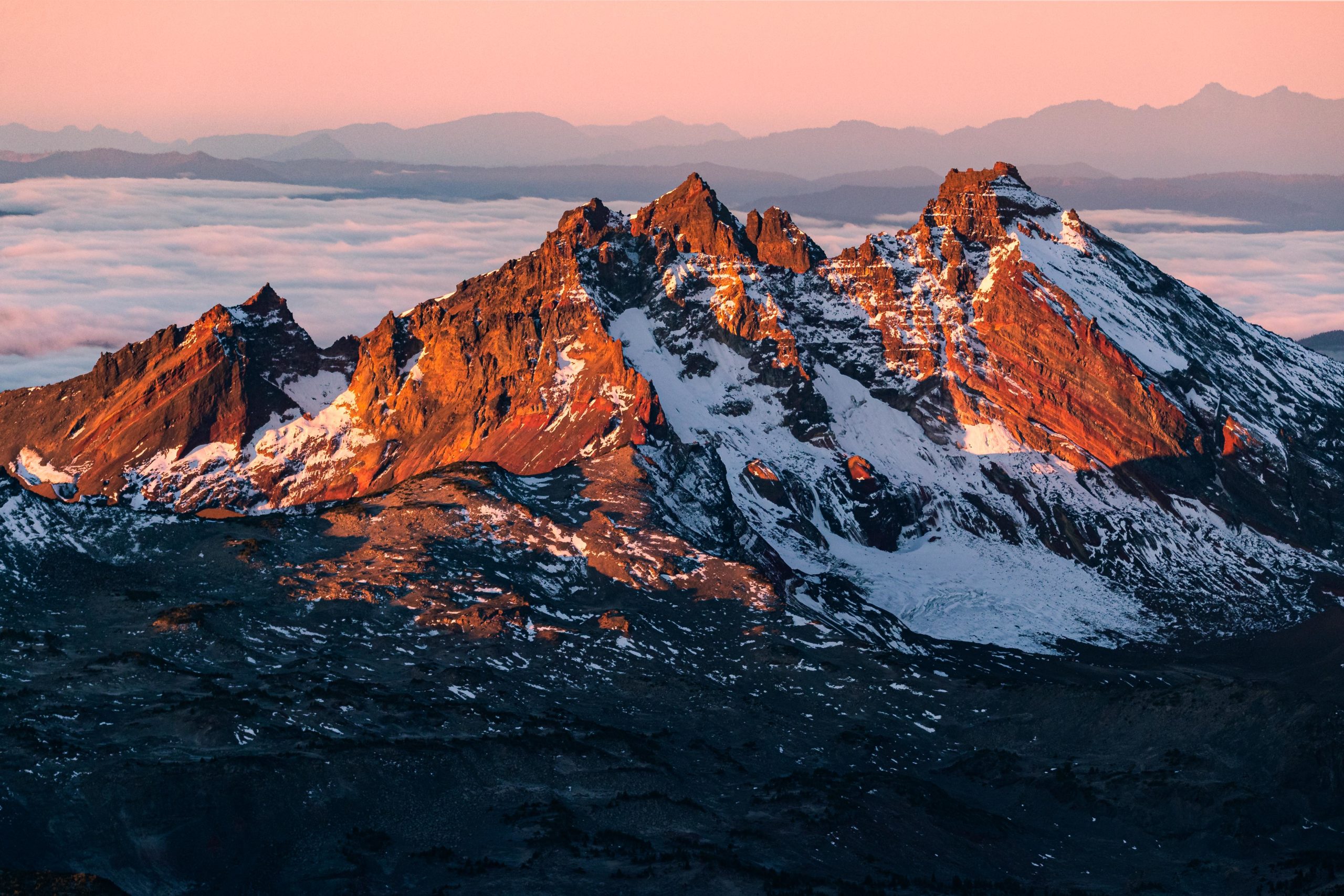
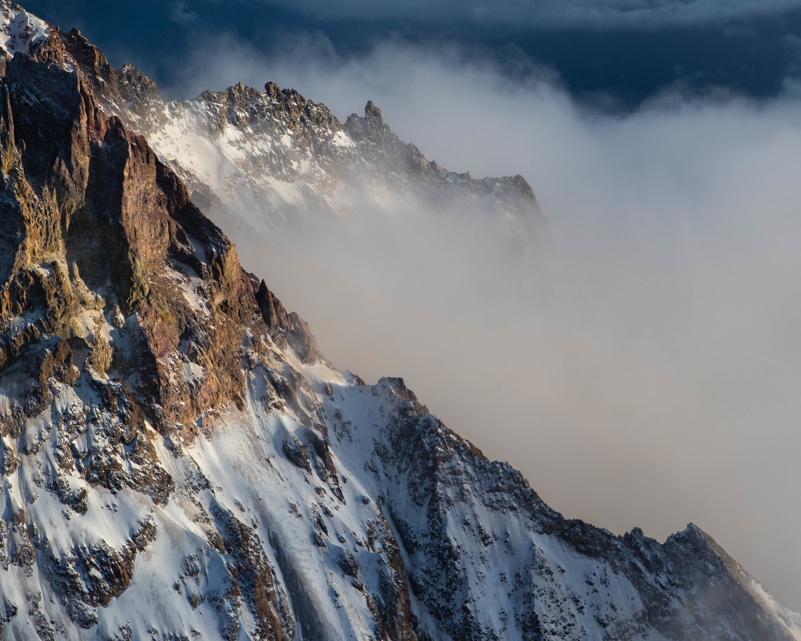
As the sun began to rise. we flew towards Broken Top Mountain’s western face and I noticed the sunlight striking the mountain particularly well. The light from the rising sun interacted with the orange and red striations on the mountain’s jagged peaks.
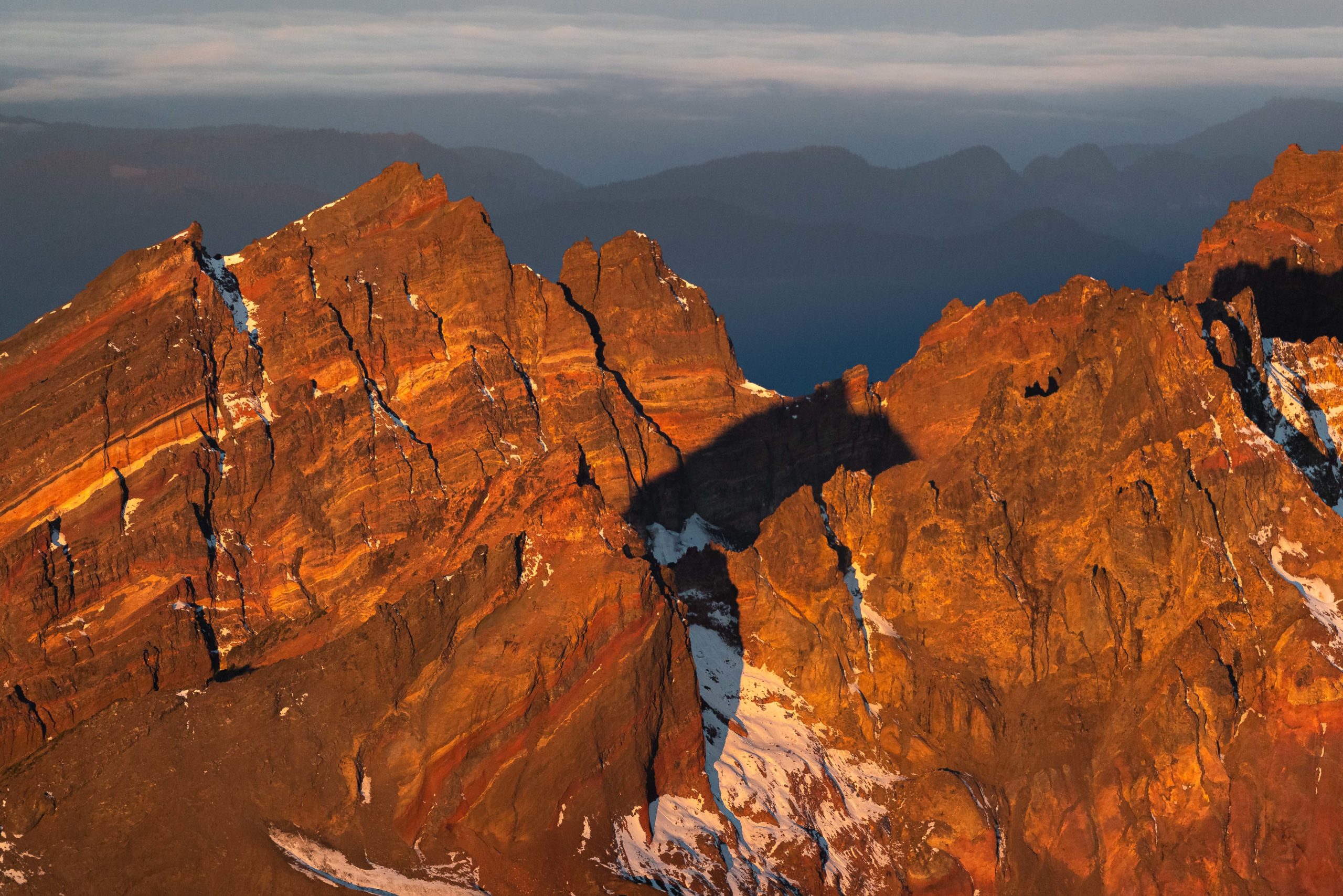
One of my favorite aspects of using a telephoto lens while on an aerial shoot is that you don’t need to move far to get a vastly different image. From a zoomed in perspective, foreground subject mountain stays relatively consistent while the background mountains 20-75 miles away quickly change and align themselves at a fast rate.
It was incredible to see how different the mountain looked from each perspective and how quickly our view changed as we flew.
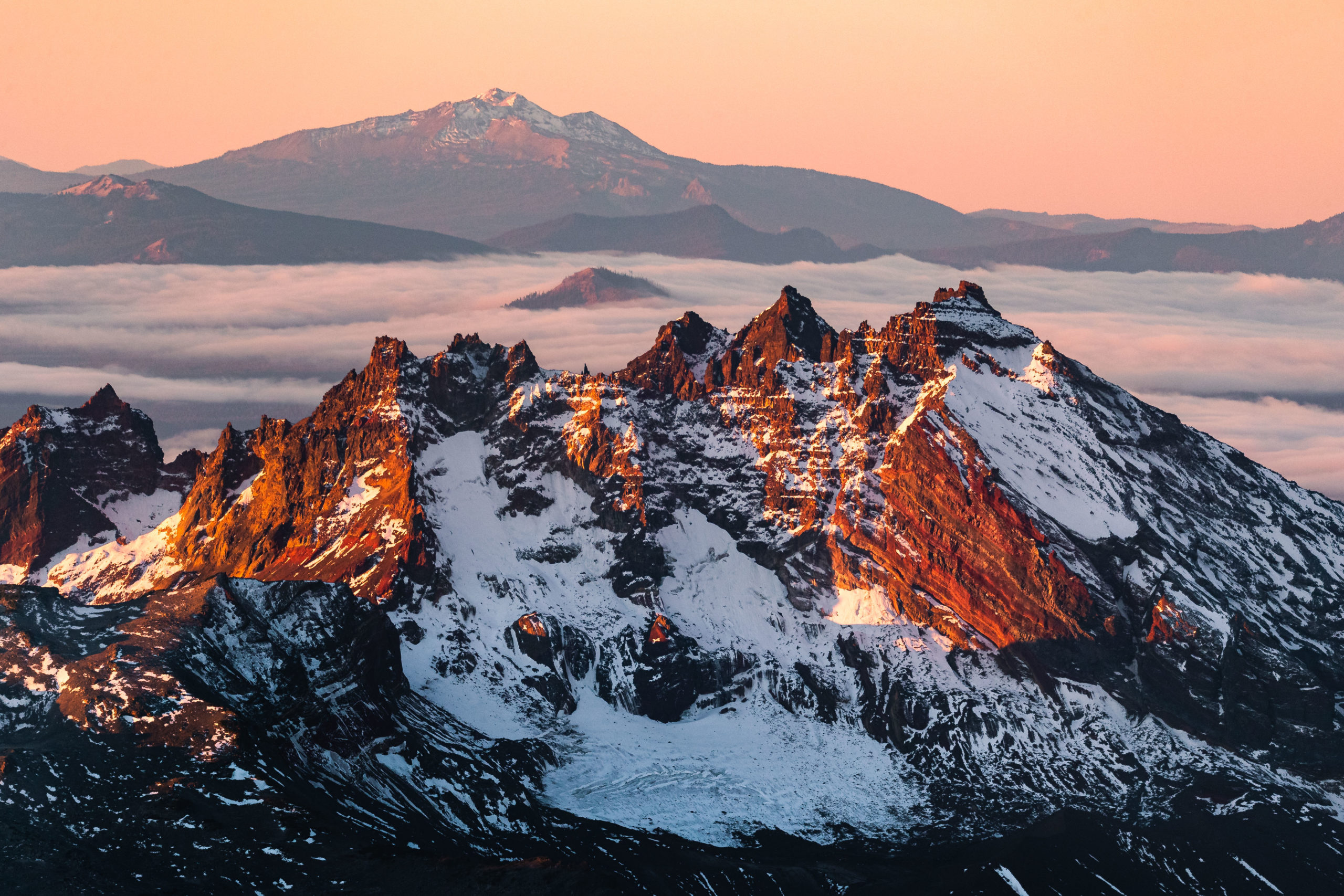
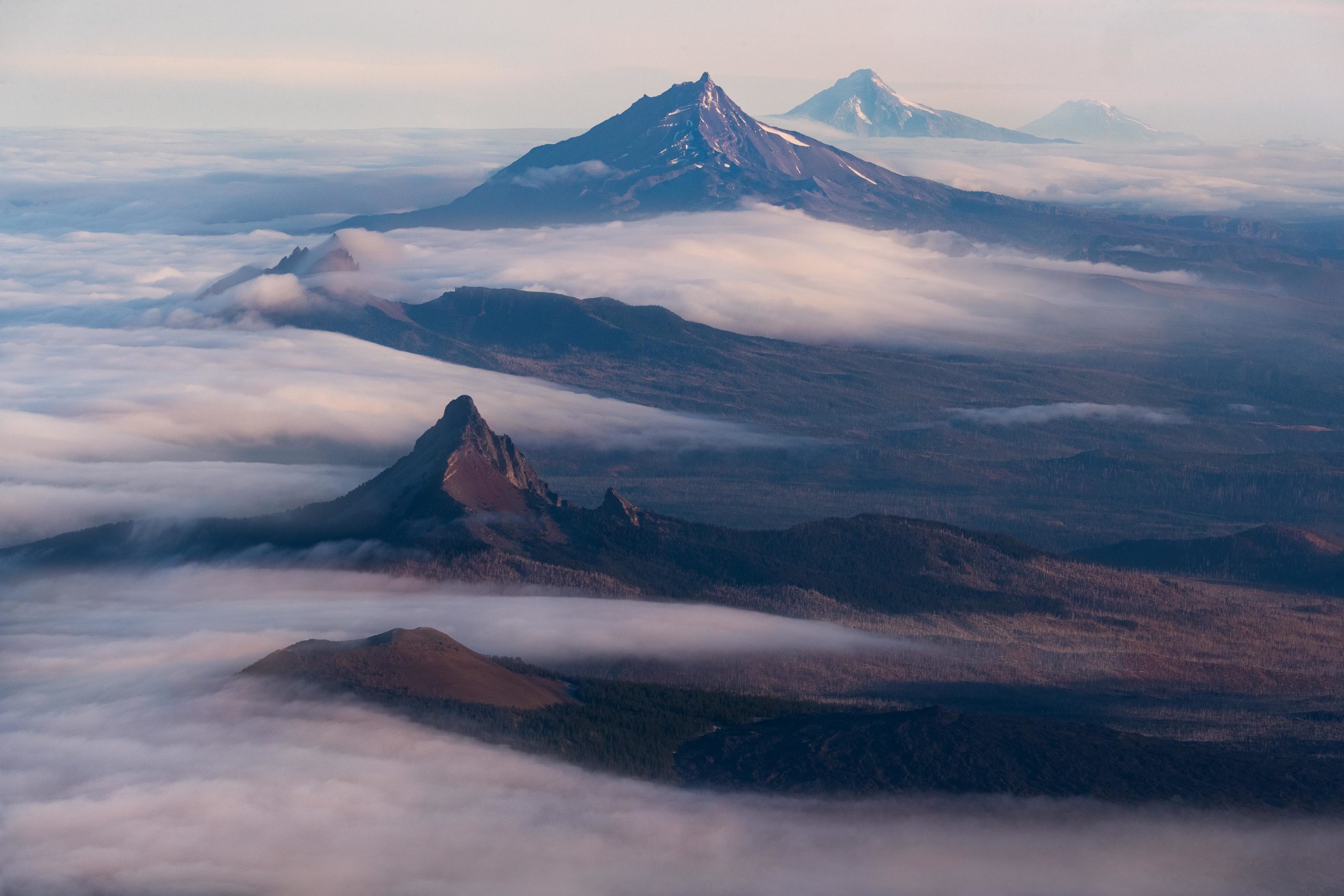
Although I wish I shot it earlier in the morning with better light, I was pleased with this aerial image of the Sisters Mountain Range with Mount Washington and Mount Hood in the distance.
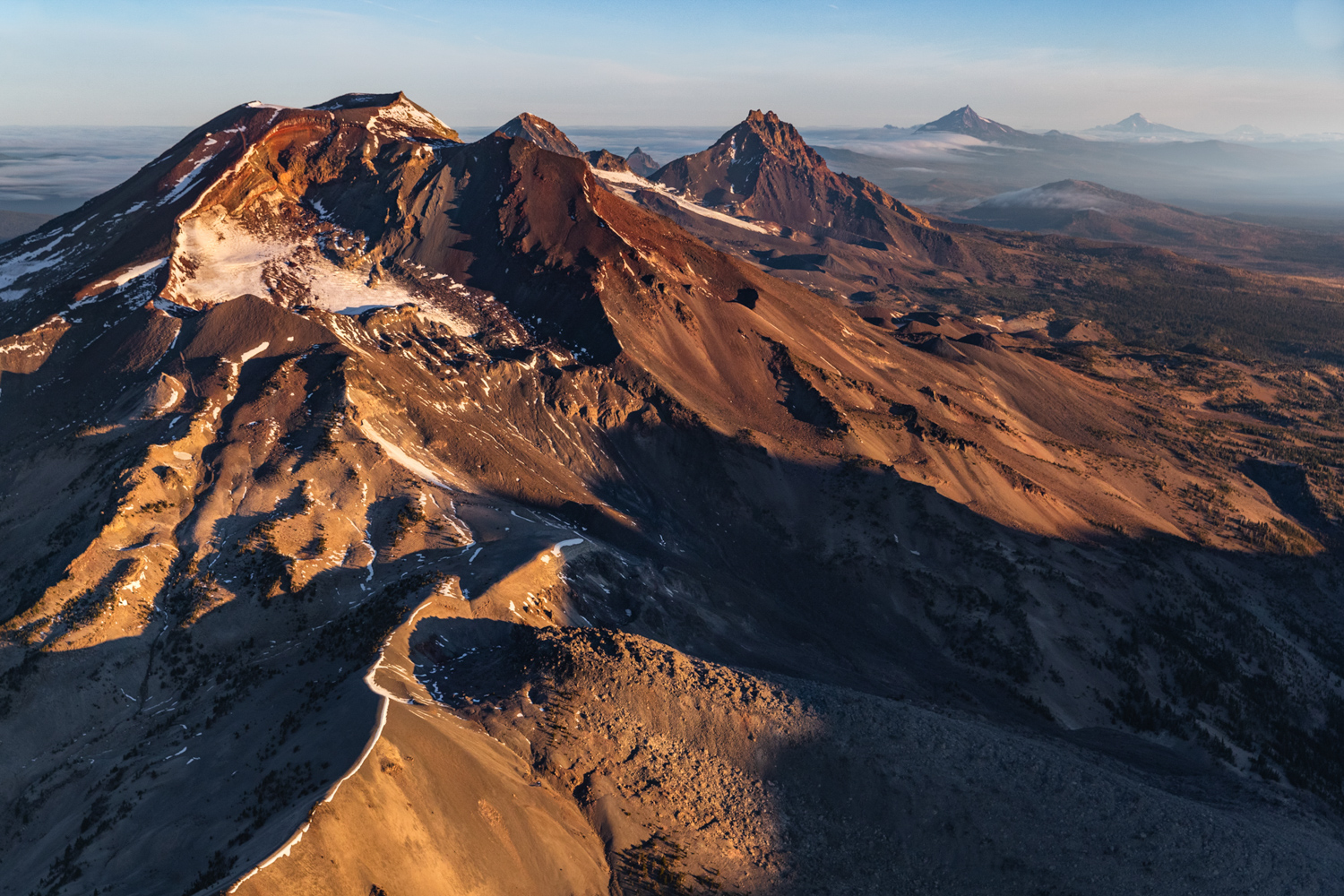
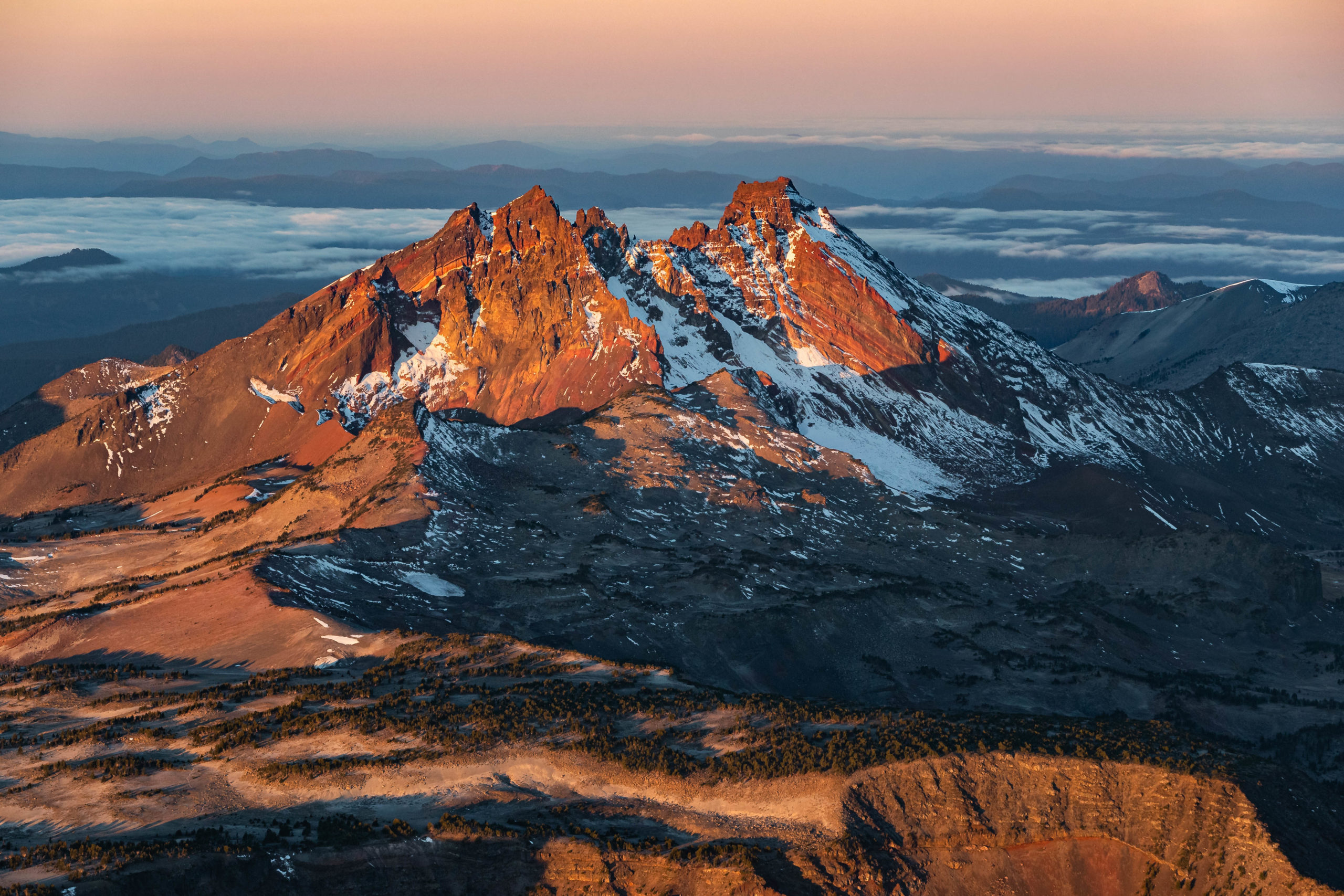
For me, the beauty of Central Oregon is told in this image. Here we see Belknap Crater, Mount Washington, Three Finger Jack, Mount Jefferson, Mount Hood and even Washington’s Mount Adams rising above the clouds all in one frame. This image also illustrates what is known as the ‘rain shadow’ effect where moist air comes in from the west and becomes blocked by the mountain range. It is what causes the dry and arid climate east of the Cascade mountains.
As the sunlight gradually became brighter and more direct, my eye went to photographing the light moving through the foggy forests below. I loved the way the forests looked as sunlight broke through the trees and created some stunning light beam effects.

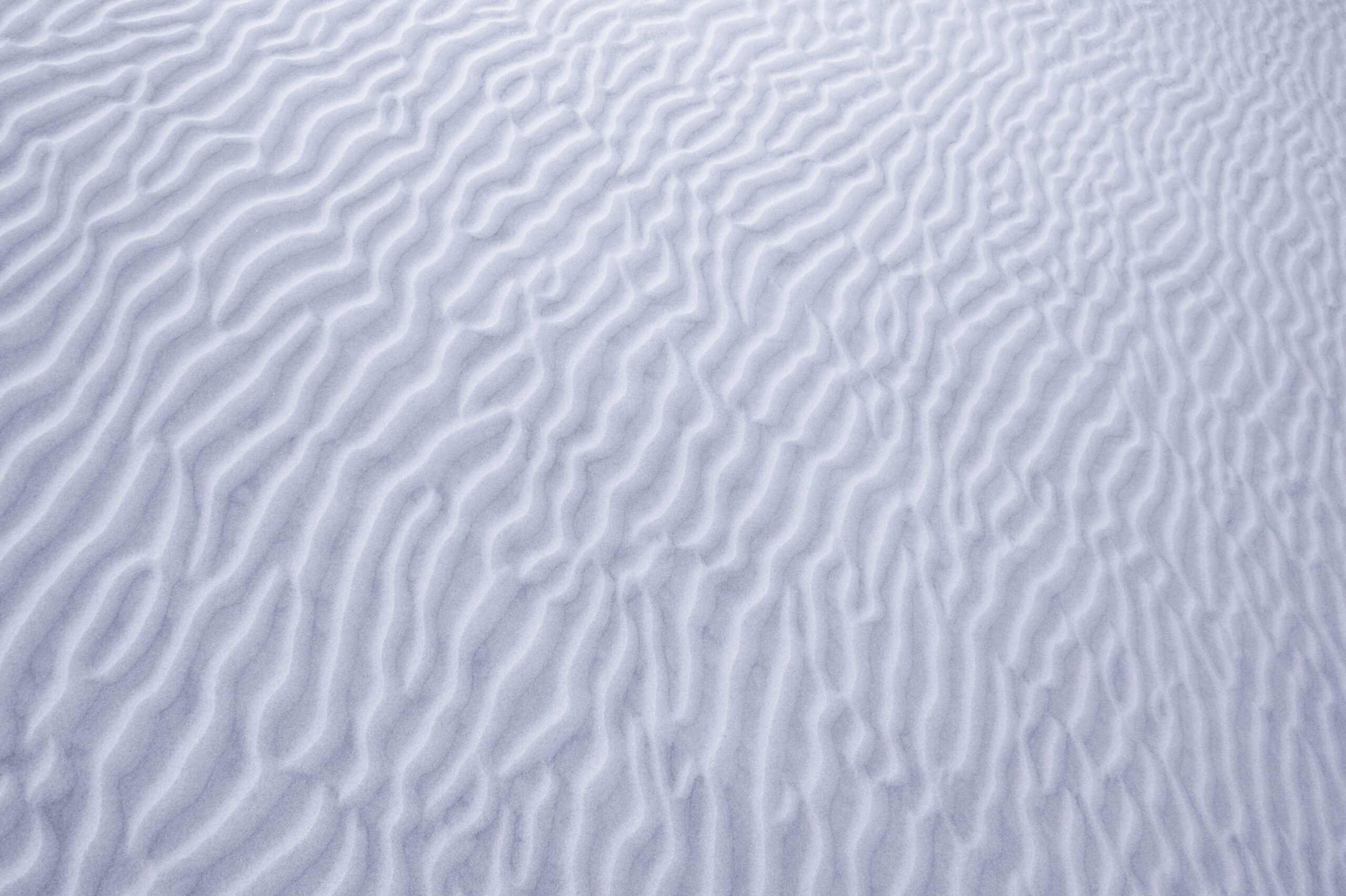
We also flew over Central Oregon’s Sparks Lake which had dried up after a long, hot summer. The lack of water at Sparks Lake exposed these gorgeous patterns and it looked stunning from above!
With the light becoming less ideal for photography, we began to make our way back west and into Portland. As we flew away from the Central Cascade Mountain range, I was able to capture a few additional aerial photographs of the mountains.
Mount Hood Aerial Photography Collection
The day before photographing this collection, I was on Mount Hood putting together a similar aerial landscape photography gallery.
Mt Hood Sunset Aerial Photography
While on Assignment for Qatar Museum’s Year Of Culture, I had the opportunity to photograph this collection of aerial images featuring Oregon’s Mount Hood. Accompanying me on this flight was my go-to and trusted pilot, Christian Walker as well as my good friend and Qatari counterpart for the Year of Culture photo assignment, Khalifa.
The following images are a small portion of what was created for a collaborative gallery between myself and Khalifa called “Light & Shadow: A Visual Journey Through Oregon” which is currently on display at the Qatar Institute of Culture in Washington DC. Special thanks to photographer Michael Shainblum for curating the gallery and for producing!
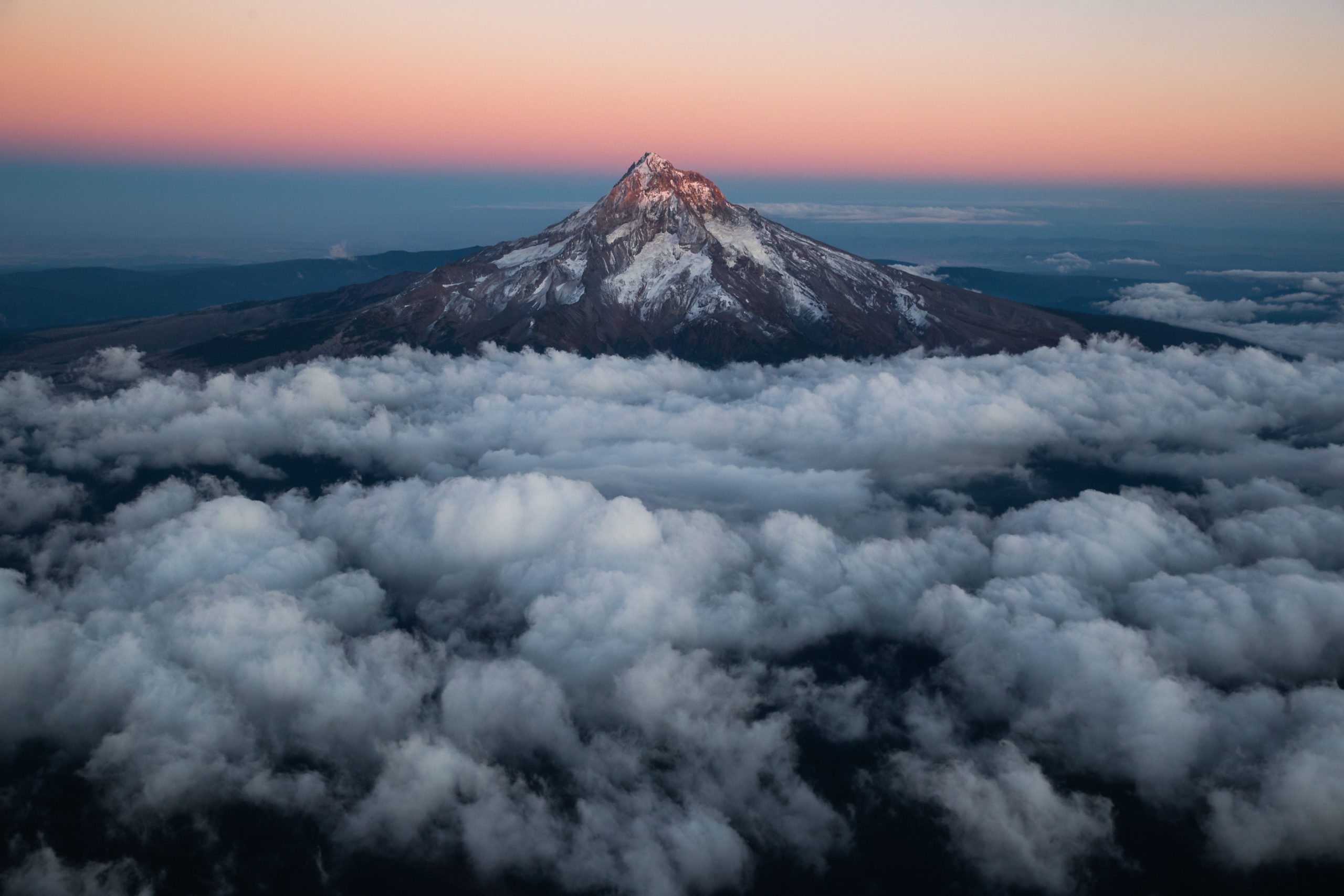
Our first photography flight was out to Oregon’s Mount Hood in the early evening. Once we took off and reached a higher altitude, we were finally able to see the mountain that was masked in clouds below. I started the shoot off by using a telephoto lens to focus on various portions of the mountain. I liked how doing this made my images appear to be more abstract and harder to recognize.

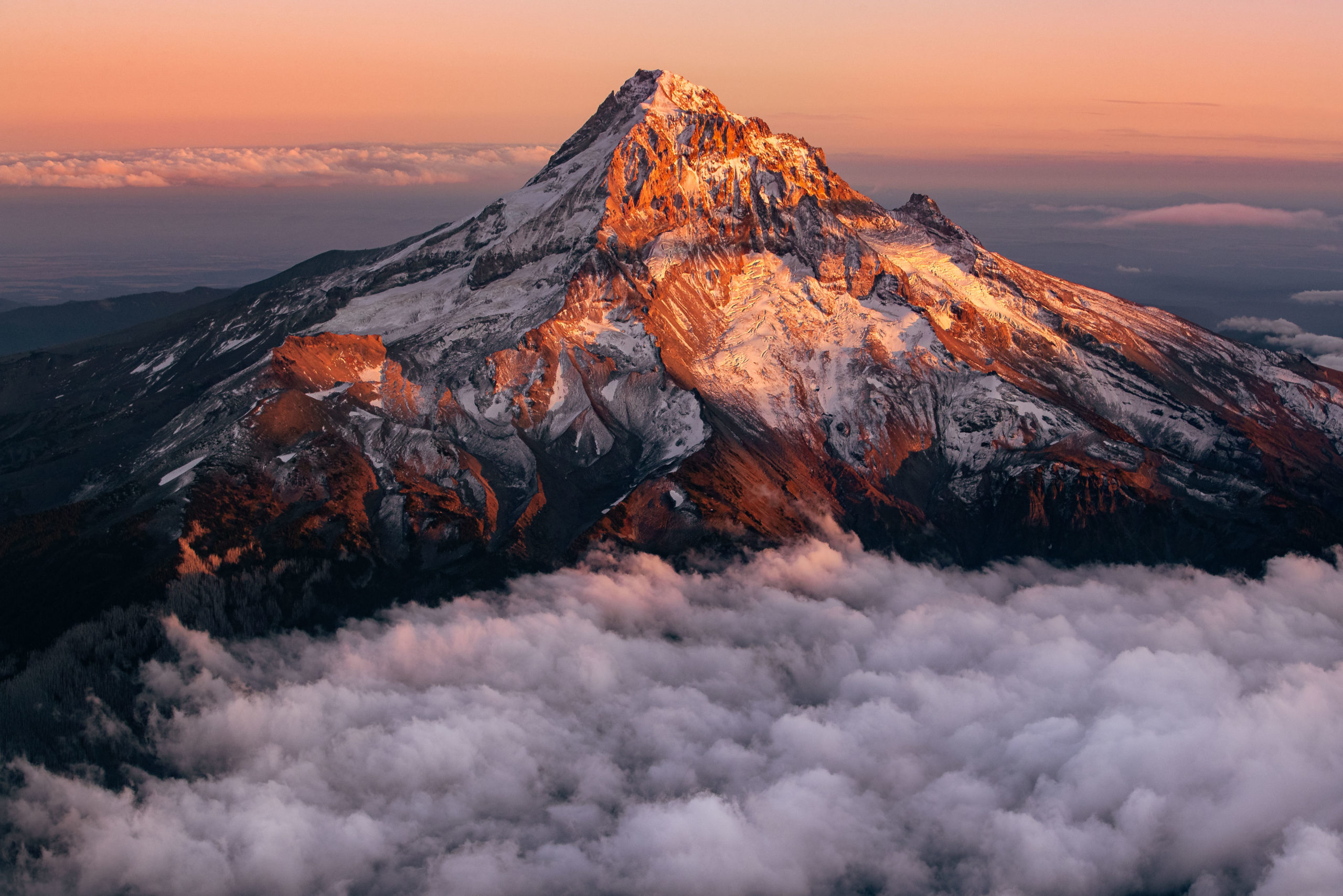
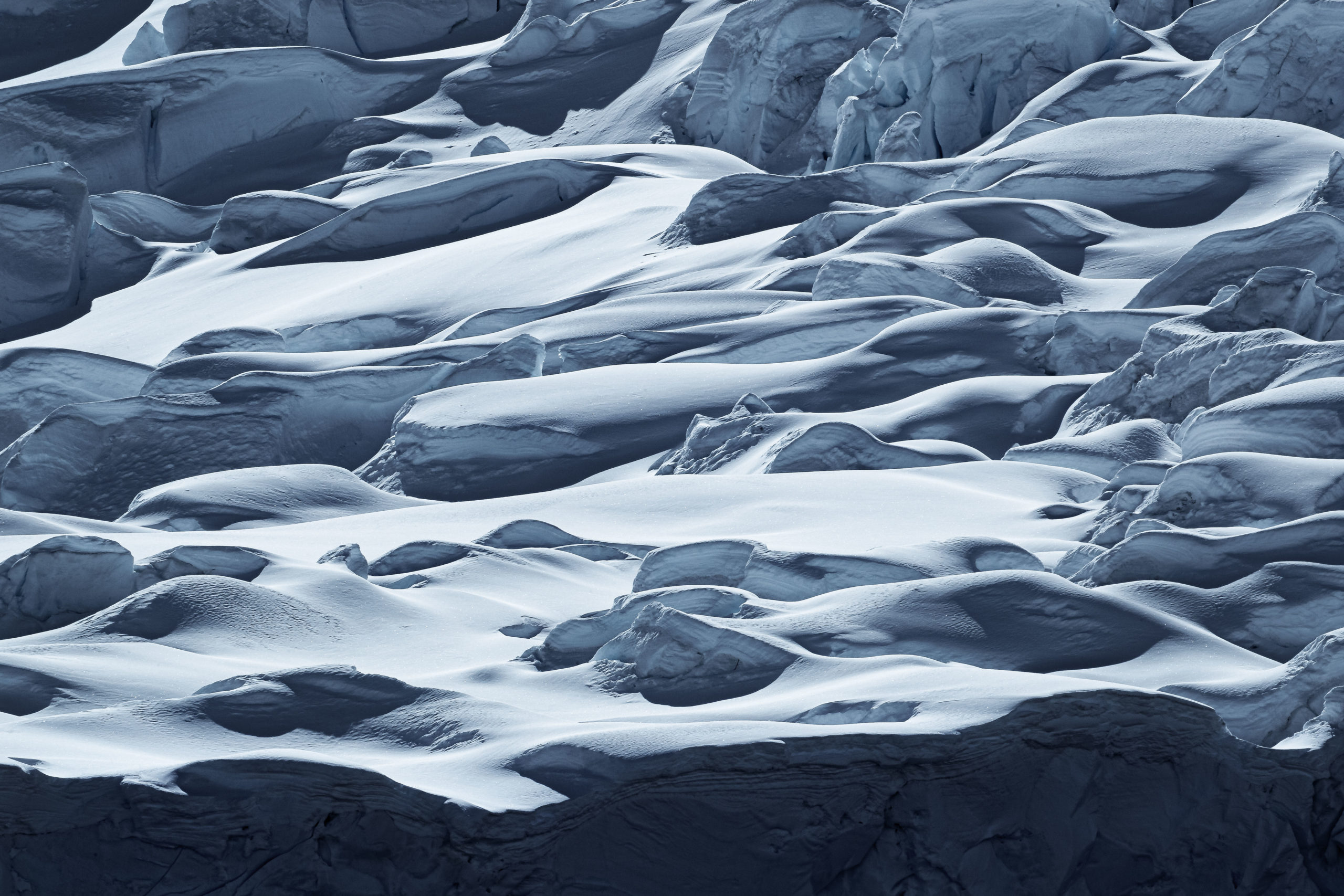
I also noticed Mount Hood’s Sandy Glacier through the clouds as it was catching some beautiful light from the setting sun. We moved closer to the mountain so we could photograph looking down on the glacier. I enjoyed photographing these telephoto closeups of the glacier’s jagged and abstract patterns. Having a birds eye view aerial perspective was a really special way to view the glacier as well as photograph it!
Time seemed to move so fast. Even though we had already been up for about an hour and a half, the sun began to set and the final moments of golden sunlight on Mount Hood was stunning. Paired with the low clouds hugging the base of the mountain, the remaining images of this flight were some of my favorite aerial photographs of the mountain I have ever taken!
The light quickly faded and we made our way east towards Central Oregon to focus on photographing the Central Cascade mountains at sunrise the following morning.
Aviation Photography Over Oregon
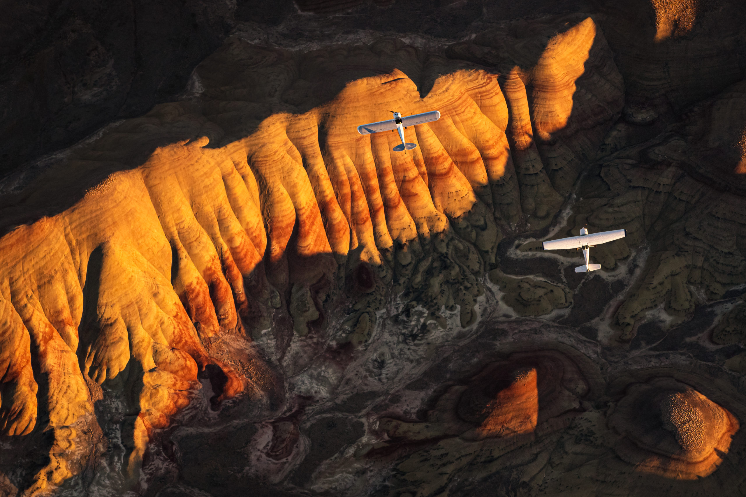
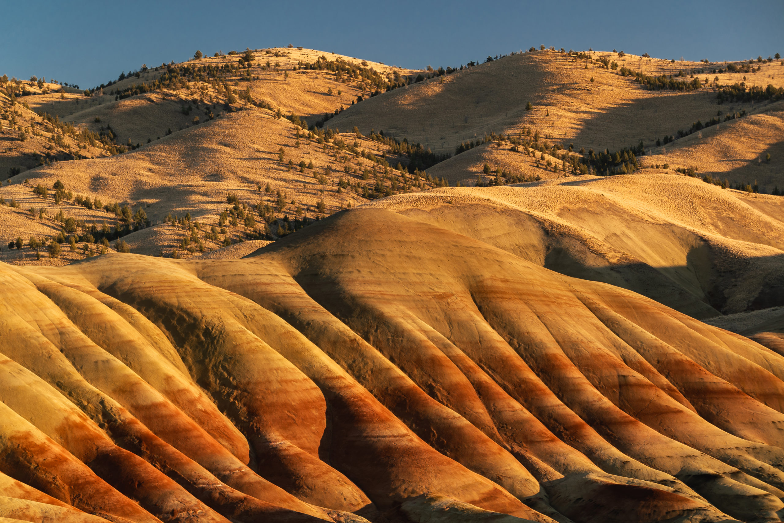
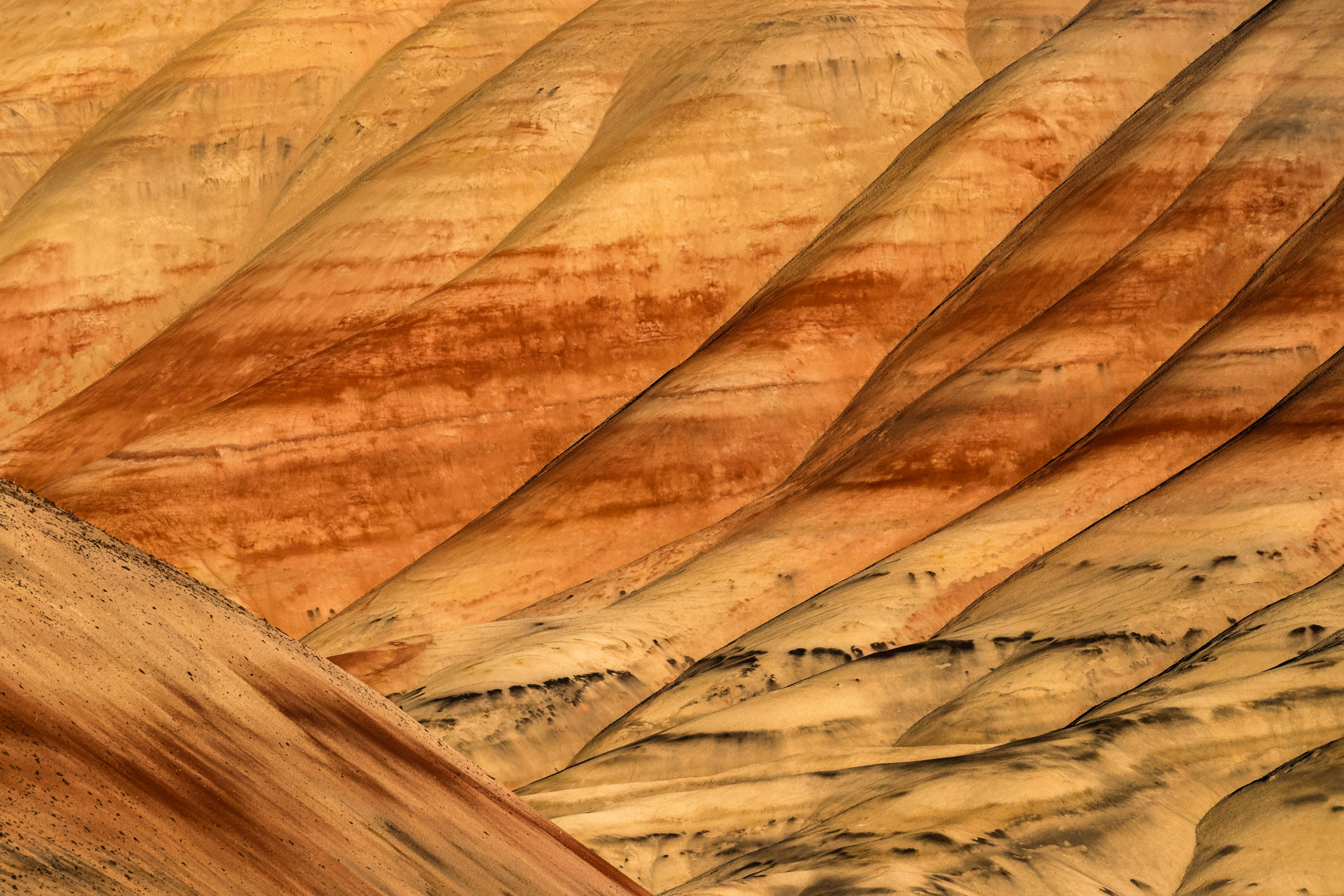
Recently, I set off on a flight with the goal of capturing an image that combines the aviation experience with one of Oregon’s most beautiful and unique landscapes; the Painted Hills. From an aerial perspective, the intricate striations, colorful patterns and overall history of the Painted Hills and John Day Fossil Beds become so apparent. The yellow portion in the hills are from a drier and colder period in time while the soil found in the red bands is actually from a more tropical point in time. Thanks to a team effort with several talented pilots, and a whole lot of planning, I was able to capture the following collection of aerial images in camera with zero compositing or layer blending.
In partnership with Dell, this behind the scenes film was produced which documents how I was able to create this photoseries. I hope you enjoy the making of film!
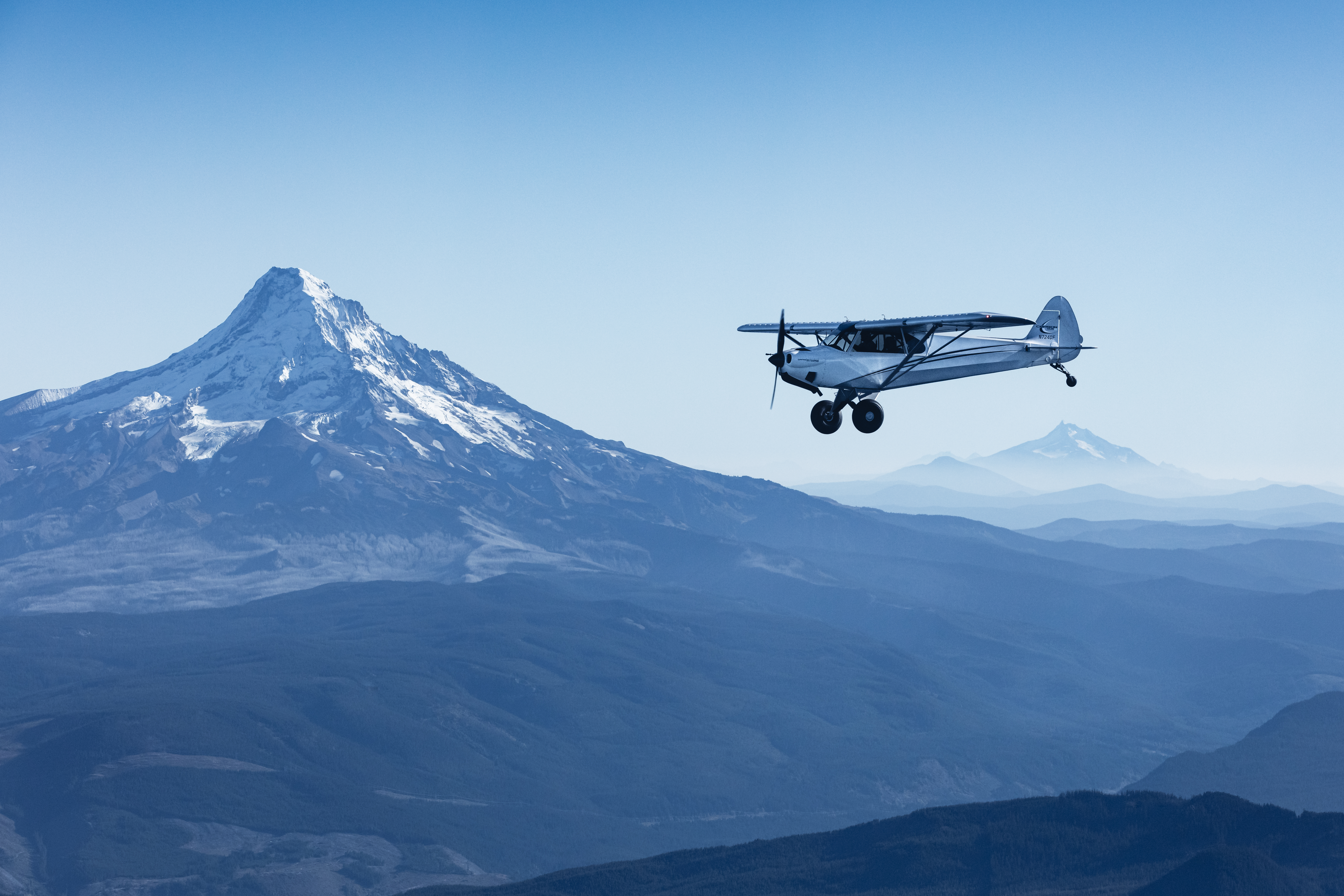
We began the flight from Twin Oaks Airpark near Hillsborough, Oregon and flew east towards Central Oregon. Within thirty minutes or so from takeoff, we had beautiful views of the Cascade Mountain Range. Although the light wasn’t quite ideal, I shot the image below of pilot Brody Fry’s Carbon Cub plane with Mount Hood & Mount Jefferson in the background.
After another hour or so of flying we stopped for fuel fuel at an airport and met up with a third pilot who would join us over the hills. Shortly after, we were above the hills with evening light beautifully illuminating the colorful patterns & striations.
After several failed attempts and a short amount of time until the light would leave the hills, the lower two planes finally looked as though their flight path would align with the landscape from my perspective another thousand feet above. In less than a second, the two planes crossed over the hills and I had the shot.
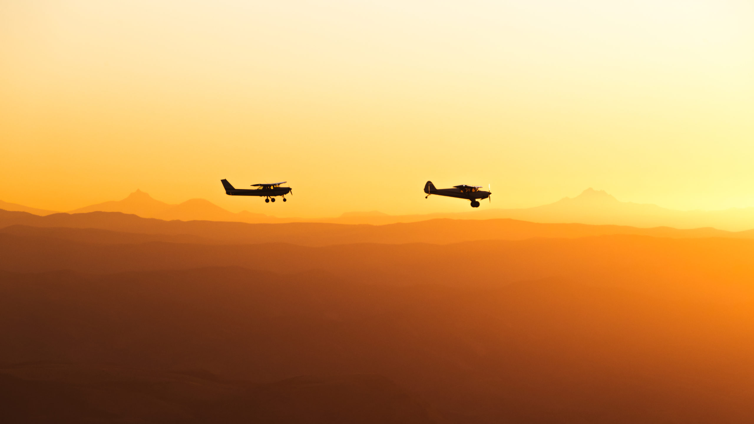
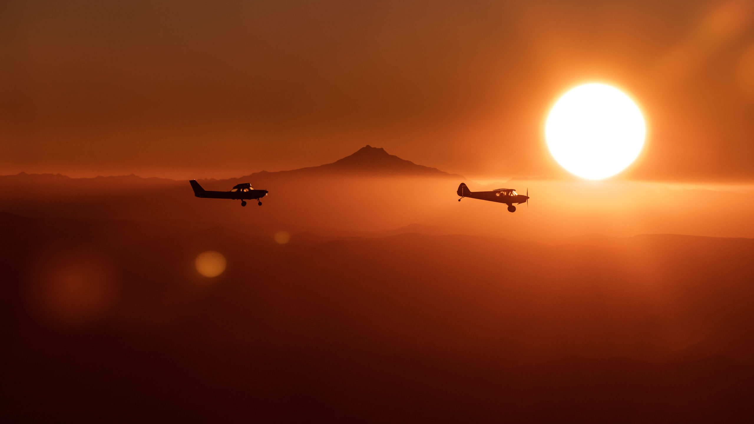
Shortly after, the light had left the hills and we refocused our efforts for sunset photography of the two planes with Mount Jefferson, Mount Hood & the Sisters Mountain Range far off in the background.
To process these images, I used Adobe Lightroom on my Dell XPS 17 with NVIDIA Studios’ RTX 2060 Graphics Card. Although my editing process was very minimal, the overall speed and capabilities of this system are truly impressive. Use your mouse to slide and see a before & after view of my editing process below.